Blaenavon Ramble
This circular route travels west from Pontypool to Llanhilleth, then heads north up the Ebbw Fach Valley to Brynmawr. Dropping down to Blaenavon the route then climbs over Mynydd y Garn-fawr where it finally returns along the M&B Canal.

OVERVIEW
Blaenavon Ramble
Locations include: Pontypool/New Inn, Llanhilleth, Brynmawr, and Blaenavon
Total Distance: 35.8 mi. / 57.61 km (round-trip)
Elevation Change: + 2,647 / - 2,646 ft
Approximate Travel Time: 5 - 7 hours
Ride Level: Advanced
Total Distance: 35.8 mi. / 57.61 km (round-trip)
Elevation Change: + 2,647 / - 2,646 ft
Approximate Travel Time: 5 - 7 hours
Ride Level: Advanced
Get ready to ramble! This diverse and scenic ride will first guide you up the historic Ebbw Fach Valley showcasing the small towns and verdant landscapes of "the Valleys"; once known for its coal mining, iron and steel production.
The second half of the route then climbs over the Blorenge for a wander through the lush Vale of Usk before joining the traffic-free towpath of the Monmouthshire & Brecon Canal as you slowly wind your way back to Pontypool.
Highlights of the route include; the Guardian at Six Bells, the Nantyglo Roundhouses, Blaenavon Heritage Railway, Blaenavon World Heritage Centre, including; Big Pit National Coal Museum, and Blaenavon Ironworks (to list a few). Also you'll be rewarded with nearly four miles of relaxing cycling along the stunning Monmouthshire & Brecon Canal.
Quite simply, there is a lot to see and explore. Although I've primarily outlined this route as a single-day tour, you could quite easily spread the ride acoss two days so that you can properly visit the many attractions. With a nights stay in the sumptious Lion Inn in Blaenavon, you'll have the convenience and time to see it all.
The overall route is very straight-forward, yet it is designed for experienced cyclists who are confident with cycling long distances and sometimes along moderately busy roads. It's not exceptionally difficult, but it does offer a few challenges; there are several steep climbs and one very steep descent. It's an excellent adventure for cyclists confident with their skills, using equipment suitable for long rides, and individuals physically capable to spend five to seven hours on their bikes cycling over 35 miles.
The map shown above is divided into two sections to assist with navigation. Downloadable versions of each section are available at the end of this guide in the ADDITIONAL DETAILS.
Table of Contents
You may jump directly to either section of the route by clicking the section title below. Additionally, at the end of each section you will find links to return to this TOC.

PART ONE
The first 10 miles are both on-road and traffic-free along NCN Route 466 and NCN Route 465. Once in Aberbeeg the route becomes mostly all traffic-free for the remaining eight miles into Brynmawr.

PART TWO
The route follows NCN Route 46 out of Brynmawr before joining NCN Route 492 into Blaenavon. The route then moves on-road as it climbs over Mynydd y Garn-fawr into the Vale of Usk and returns along the M&B Canal.
Relevant links and route maps are provided for print or download. Additionally, you'll find links to train station(s) and local weather.
PART ONE
| NCN | 466 | 465 |  |
Pontypool to Brynmawr |
Location include: Ebbw Fach Valley
Total Distance: 17.9 mi. /28.80 km
Elevation Change: +1,443 ft / -624 ft
Total Distance: 17.9 mi. /28.80 km
Elevation Change: +1,443 ft / -624 ft
Begin your ride by leaving the the Pontypool/New Inn train station along the (poorly named) "Highway Road". After roughly .25 mile(s), however; you will then drop down onto the Monmouthshire & Brecon Canal (NCN Route 49). Only going another .25 mile(s) once again, you'll exit the canal at Pontymoile Basin. Here you'll find the lovely Boatyard Tea Room sitting alongside the basin.
The next section can be rather tricky as you snake your way through Pontypool Park and then ride along the High Street of Pontypool proper to a busy double-roundabout. Once across the roundabouts the you will join NCN Route 466 and the route soon exits town as you begin a rolling three mile ride along the very quiet Old Crumlin Road.
There are facilities by the leasure centre within Pontypool Park, as well as a coffee shop. Of course too, you'll find most anythng you might need along the High Street.
| ▲ Back to |
| ROUTE COLOUR KEY: | Traffic-free | Shared Use | Quiet Road | Steep Hill |
Let's get going!
Less than .25 mile from the Pontypool/New Inn train station along Highway Road (not really a "highway", just a poor choice of a name...) you will come to a small bridge crossing over the Monmouthshire & Brecon Canal. You should see the entrance dropping down to the canal just before the bridge on the left-hand side.

Once on the canal towpath, you've less than .25 mile to reach Pontymoile Basin. Here you will exit the canal and make your way across to Pontypool Park.


The Boatyard Tea Room has limited hours, but there is also a coffee shop (as well as toilets) in the leisure centre just ahead in Pontypool Park.


The entrance to Pontypool Park is down the road from Pontymoile Basin and is clearly recognizable by the lovely Pontymoile Gates. (Currently marred by the Covid 19 sign.)


The area around the leisure centre can often be crowded with pedestrians and children from the nearby playground, so show caution (ring your bell!) There is large cafe with indoor and outdoor seating. The toilets are in a seperate builidng (shown on the left in photo above).


Once through the park, navigating the High Street is quite simple. There are no route signs, so you'll need to follow the map closely.

At the end of the High Street you reach a double roundabout.

Cycling through the roundabouts can be a little tricky, but if you take your time it can be done safely and without too much difficulty. I grabbed the two images (above and below) from Google Streetviews because stopping to take photos is not so easy.
Note: There is an option of riding your bike over a footbridge to avoid the roundabout(s) (shown in image below), but getting to the path is somewhat difficult as you must navigate the very busy Tesco's car park (on right) and then descend a set of stairs at the far side of the roundabouts.

Approximately .5 mile past the roundabouts, you'll find yourself heading out of town on Old Crumlin Road (NCN Route 466). You'll cycle along this quiet road for three miles before crossing the A472 where you'll then join a traffic-free section to the village of Hafodyrynys.


It looks like a spaceship, but it's not! This unusual building was once the coal washery for the Hafodyrynys Colliery and a wonderful landmark along the route.

Soon after passing the washery you will come to a junction where you will need to cross the A472. The road can be very busy, so show caution. (Be prepared to get off your bike and walk.) Once on the other side, you've a lovely traffic-free section for about a mile to Hafodyrynys.

The traffic-free section ends at Hafodyrynys where you'll briefly cycle past several sets of terrace houses, cross back over the A472 (this time with a traffic light!) and enter the village of Sofrydd along the road.


In Crumlin you'll join a traffic-free path again for a short, but fast glide down into Llanhilleth.


NCN Route 466 ends at the bottom of the hill where it joins NCN Route 465 which you'll follow for the remainder of the ride to Brynmawr. Here too you'll exit the cycle path and follow along a very quiet road to the Llanhilleth village High Street.


Coming into the village you'll soon find quite a steep descent down to the Llanhilleth Train Station (photo above). Then at the bottom of the hill you'll take a left turn and cross the bridge over the train tracks (photo below).


Once over the bridge (and just past the Miner's Institute), turn right to make your way down the narrow road of terrace houses and then a small industrial estate before dropping down alongside the Ebbw River. There are several turns left and right, but traffic is very light and the route (NCN Route 465) is clearly marked.


After you pass a lovely row of houses in Aberbeeg (above), you'll come to a subway under the railway line (below). Cars generally toot their horn, but it's dark and narrow with the slight turn in the middle, so show caution (ring your bell!).

As you exit the subway, you'll find a sharp, but short climb followed by an immediate right-hand turn leading under yet another bridge where the route becomes traffic-free along an abandoned passenger platform.


NCN Route 465 gently climbs through the woods for the next 1.5 miles to Abertillery.


Six Bells & the Guardian
As you approach Six Bells, look to your left, you might catch a glimpse of the Guardian through the trees. Just ahead is Parc Arael Griffin and you might want to make a brief stop to view the sculpture closer.
| ▲ Back to |

It's well-worth your time to spend a few moments exploring the parc... to read the information boards, to think about life and how fortunate you are to be cycling — carefree through the countryside.
On the morning of 28 June 1960, tragedy struck the small mining community of Six Bells. Firedamp ignited coal-dust trapped in the poorly ventilated air of the mineshafts causing a massive underground explosion, killing 45 men and boys almost instantly.

 On 28 June 2010, exactly fifty years after the explosion, a commemorative service led by the Archbishop of Canterbury unveiled the statue to a crowd of nearly 7,500 people from across the world, including four hundred relatives.
 Dedicated to all mining communities and the hard sacrifices made by their families — wherever they may be, the names, ages, and home town of each of the the 45 victims who lost their lives here are cut into steel plates which surround the lower section of the plinth.
 Behind the statue stands a small information board which presents a truly chilling poem written by Gillian Clarke; National Poet for Wales, 2008-2016.
At a cost of over £200,000, the Guardian is constructed from over 20,000 horizontal rings of COR-TEN steel which allow a protective patina of rust to form on its surface.
Each ring is slightly separated from the next so that from a distance the sculpture appears semi-transparent. Yet upon closer inspection, the gaps disappear giving the sculpture a solid appearance, with well-defined features. Additionally, when viewed from certain angles the seperated rings create a moiré effect as the steel sections appear to shimmer in the light.
Often compared to Sir Antony Gormley's Angel of the North, the statue itself is 12.6 m (41 ft) tall, weighs over eight tonnes, and stands on a sandstone plinth 7.4 m (24 ft) tall. In November of 2011, Prince Charles visited the statue and the visitor centre.

As you leave the park, rejoin the main cycle path and continue your adventure. It's just a short distance now to Abertillery.


The route rejoins the road for a short distance as you make your way around Tesco's car park and through a couple of small housing estates. At the end of the road you'll find Abertillery Park.

The NCN Route 465 signs can be a little tricky to spot at times, so you'll need to look carefully. But once you're at the park it becomes very straight-forward again.


For the next 2.5 miles NCN Route 465 is completely traffic-free as it rolls along through the woods closely following the Ebbw Fach River.


As you come out of the woods you'll see a playground to your left (photo above) and a set of gates leading onto a small service road (photo below). Turn right and head up the hill.

After a rather sharp, but short climb up the service road, the route veers left to a subway passing under the very busy A472 and into the village of Blaina.
Note: This subway can often be littered with broken glass. I highly recommend dismounting your bike and walking the short distance to the other side.


It's only a short distance along the road past the edge of Blaina to where you'll turn onto a shared-use path heading north alongside the A472.
This section runs for just under two miles before exiting onto a small local road which then crosses over the A472 into Nantyglo.
This section runs for just under two miles before exiting onto a small local road which then crosses over the A472 into Nantyglo.

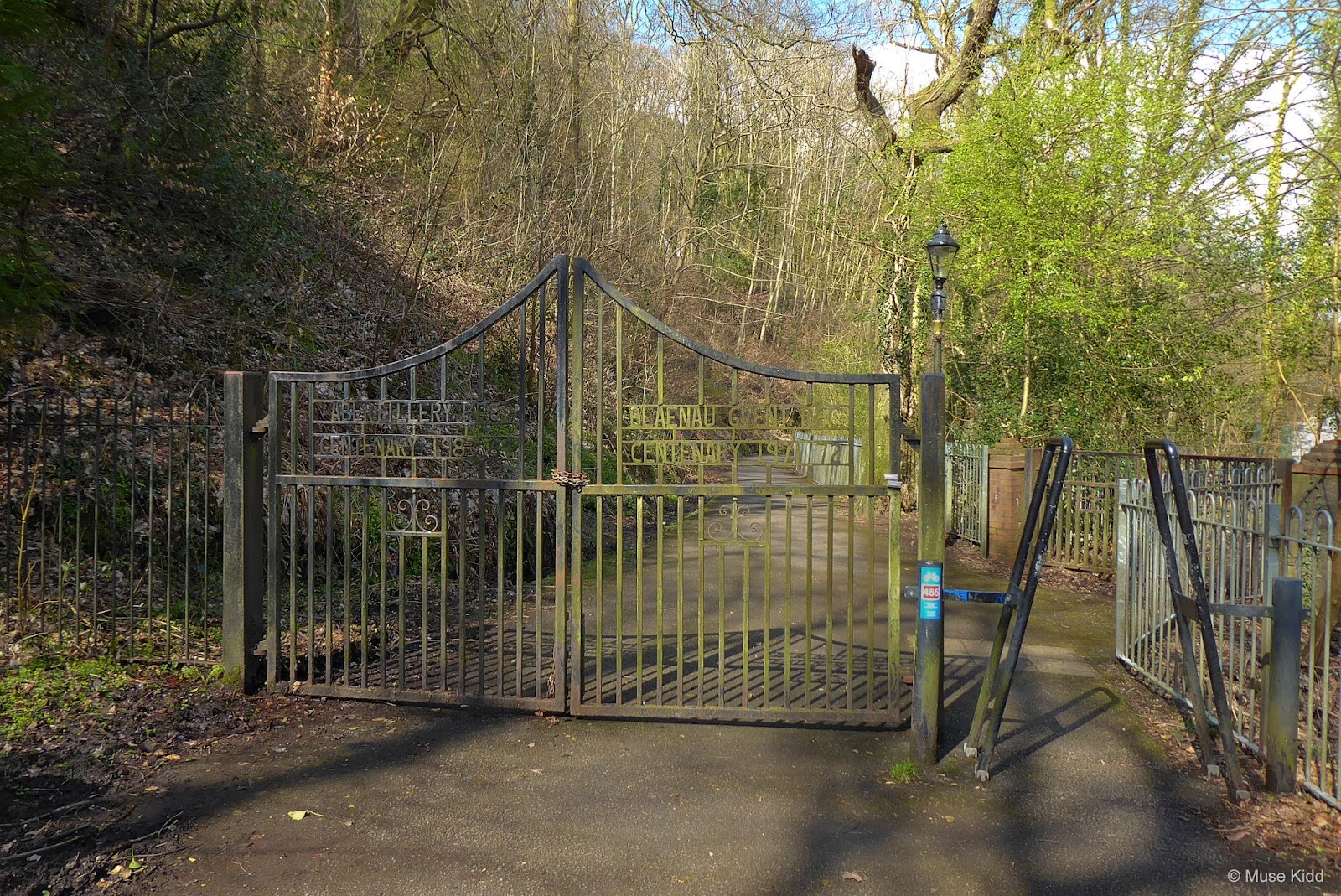
Once in Nantyglo and roughly .15 mile from the bridge, you should see a small brown sign pointing off to the left for the Nantyglo Roundhouses. It's only a very short detour and rather interesting to see the remnants of last fortified house built in Wales.


Back on the road, the route continues through a housing estate which then leads to another short section of traffic-free cycling into the town of Brynmawr. Shortly NCN Route 465 ends as you merge onto NCN Route 46. Both routes are clearly marked.

Turn right onto NCN Route 46 and follow the road for less than .5 mile into the town centre. You'll soon reach the Brynmawr bus station and town square where you'll find plenty of places to grab a sandwich and tea or coffee. (The pubs can also be very accommodating with the use of their facilities.)

This is the end of Part 1 of your adventure. You've traveled nearly 18 miles, climbed over 1,400 feet, and this is a great place to stop for a well-deserved break.
PART TWO
| NCN | 46 | 492 | |
Brynmawr to Pontypool |
Location include: Blaenavon, Vale of Usk, and the Monmouthshire & Brecon Canal
Total Distance: 17.9 mi. /28.80 km
Elevation Change: ++1,204 ft / -2,022 ft
Total Distance: 17.9 mi. /28.80 km
Elevation Change: ++1,204 ft / -2,022 ft
The second part of your ride continues out of Brynmawr along NCN Route 46. Exit the bus station by following the little blue signs and you zig-zag your way through a small housing estate for approxiamtely .5 mile to cross a narrow pedestrian bridge.
Once on the other side of the bridge, you'll pass through one more housing estate before entering the traffic-free path heading up onto a high ridge. The route is well-marked, but there are quite a few turns. Follow the map and take your time.
Once on the other side of the bridge, you'll pass through one more housing estate before entering the traffic-free path heading up onto a high ridge. The route is well-marked, but there are quite a few turns. Follow the map and take your time.
| ▲ Back to |
| ROUTE COLOUR KEY: | Traffic-free | Shared Use | Quiet Road | Steep Hill |
Nearing the end of the housing estate (on your left) you should see the entrance to the traffic-free path off to the right of the road. Cars are often parked near the entrance so you may need to look closely.

Soon after entering the path the route divides. NCN Route 46 veers sharply left; however, you should continue straight onto NCN Route 492 which continues up the ridge directly in front of you (photo below).

It's a mild, steady climb, but the views slowly open to a grand vista overlooking Clydach Valley. Far off in the distance, The Skirrid stands perfectly framed bewtween Llangattock Esparpment (left) and The Blorenge (right).


Next, you will come across another connection to NCN Route 46 and Abergavenny. This is the old bypass down the mountain into Clydach Gorge (that's a ride for another day!) You should continue straight, climbing NCN Route 492 and enjoy the views.


Soon you might see The Sugarloaf rising majestically along your left horizon.

NCN Route 492 continues up a slight grade for approximately .75 mile(s) before crossing Blaen Avon / Garn Road. Traffic can be somewhat busy, so show caution. It's clear to see the path continuing directly on the opposite side of the road.

This is the highest point of your journey. The next few miles are quite special as you pass through a high wide valley before dropping down into Garn Lakes nature reserve.
Note: The weather can, and often — changes quickly in Wales. You will be completely exposed on this high plateau. On the day I took these photos, the clouds blew in and within minutes the temprature dropped and it began to rain.

The path starts off paved, but soon changes over to a very unusual rubber mesh/grid. It's an interesting surface that's designed to protect the natural grasses, yet provide a smoothe and easy path to roll across.


The high open valley presents a spectacular vista... is this Wales or Montana?

As you continue, there is a short section of fine gravel where the path resembles an image from the old Amercan West. But that too is short lived, as the path drops down onto a grassy moor where you'll then pedal across some very clever raised decking for a short distance.


You'll exit the cycle path at a small service road. Turn right and proceed down a slight hill. Go slowly, take time to look around.
Also, you should note the Afon Llwyd River is channeled by concrete (shown below).
Also, you should note the Afon Llwyd River is channeled by concrete (shown below).

Garn Lakes Nature Preserve
At the bottom of the hill on your left side you will find the entrance to Garn Lakes Nature Preserve and the traffic-free cycle path.
| ▲ Back to |


Also of note: Just to the right of the path is the northernmost stop for the Blaenavon Heritage Railroad and another highly recommended place for lunch; the Whistle Inn and Campsite (shown on right side of photo above).


Read more about Garn Pit and the history of coal mining in this area at: Welsh Coal Mines and Kay and Kears Recalmation Scheme.

As you exit Garn Lakes, turn right onto the road heading down the hill. You will soon see the entrance for the Blaenavon Heritage Railway . However, just before reaching the railway station, turn left onto the traffic-free cycle path again heading down alongside the river for a very short coast to the next juction.


The path veers left and it's pretty obvious which way to go. There is a NCN Route 492 sign, but you can see the next junction down the hill anyway.

At the junction you'll see NCN Route 492 continues straight ahead on the opposite side of the road, but you will need to turn left and exit the cycle path onto the roadway (toward Rhymney Brewery shown below).
Note: Directly on your right is a railway bridge with "Rhymney Brewery" painted across its side. It's a little confusing, but don't be mislead; you need to turn left. The road under the bridge actually leads up to Big Pit National Coal Museum.

photo courtesy of Rhymney Brewery

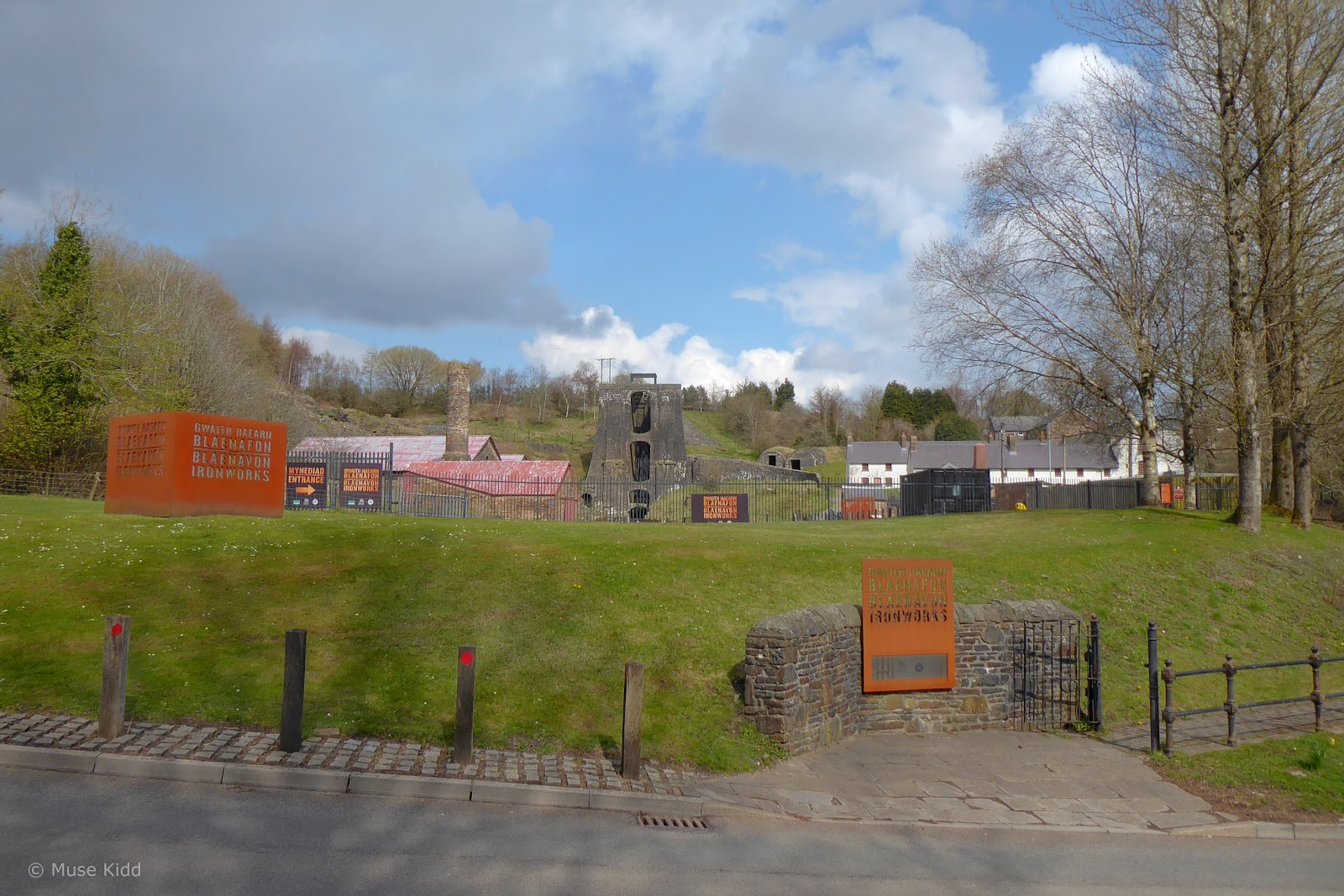
Turning left will lead you through a small industrial estate for approximately .5 mile(s) before reaching the junction with Estate Road. Directly across the road is Blaenavon Ironworks (shown below).
Turn right onto Estate Road for a very short distance before reaching the junction with B4246. This is the main road into town.
Turn right onto Estate Road for a very short distance before reaching the junction with B4246. This is the main road into town.
Blaenavon
Cycling through towns without clear instructions can often be confusing. I've included the map shown below to help guide you through Blaenavon. The town has many one-way streets and it's also quite hilly. The route suggested will guide you past some of the more interesting parts of town as well as utilizing pedestrian connectors to simplify the journey.
| ▲ Back to |
Note: If you find that you need to ask for directions, your goal is to reach Llanover Road on the far side of town.
From Estate Road, turn right onto B4246. The road immediately veers left heading down a rather steep hill with a narrow lane and no shoulder. The road can be quite busy as well, so show caution.
As you come around the bend, you will soon see the Blaenavon World Heritage Centre on your right and then the magnificent Blaenavon Workmen’s Hall, home to the Blaeavon Community Museum directly on your left.
As you come around the bend, you will soon see the Blaenavon World Heritage Centre on your right and then the magnificent Blaenavon Workmen’s Hall, home to the Blaeavon Community Museum directly on your left.


| Sidebar of Note:
In 2000, UNESCO inscribed the Blaenavon Industrial Landscape as a World Heritage Site for it's role as one of the world’s major producers of iron and coal during the 19th Century.
Today you can tour the remnants of this massive complex, including a coal mine, furnaces, quarries, railway systems, ironworkers’ cottages, churches, chapels, a school, and a workmen’s hall — all within a 33 square kilometer setting.  It's a fascinating place to visit as a testament to the human endeavour of miners and ironworkers of the past. And it's all set in a beautiful landscape favoured by walkers, cyclists, and international tourists alike. You'll need a full day to see everything – so plan ahead! |
Continue past the workman's hall to the traffic light directly ahead at the junction with Commercial Street. Turn left at the light heading up a short hill on Commercial Street, then immediately veer left again onto Ivor Street.

The photo above is looking up B4246 from below the traffic light. (You would be traveling down the road to where the line of traffic is stopped for the traffic light.) Turn left onto Commercial Street, past the large white building shown on the corner above.
The photo below is just past the junction of B4246 with Commercial Street, looking up Ivor Street (past the large white building on the corner).
The photo below is just past the junction of B4246 with Commercial Street, looking up Ivor Street (past the large white building on the corner).


Follow Ivor Street a short distance as it soon merges onto Broad Street. Veer left again and continune up the hill on Broad Street until you see the Lion Hotel.

Blaenavon is not an uncommon "valleys" town in that it has a majority of unoccupied and derelict buildings standing right alongside storefronts that are well-kept with seemingly prosperous businesses. (The Market Tavern above is in sad shape.)
Whilst the Blaenavon Cheddar Company looks wonderful as does the Lion Hotel further up the street (both shown below).
Whilst the Blaenavon Cheddar Company looks wonderful as does the Lion Hotel further up the street (both shown below).

These two examples make you wonder what the town would be like with more investment and development.

You will reach the Lion Hotel at the junction of Broad Street with Lion Street (shown above). Directly on your right will be Boot Lane; a wide pedestrian alleyway leading up a cobblestone incline (shown below).
Turn right onto Boot Lane and continue up the hill to merge onto Duke Street.
Turn right onto Boot Lane and continue up the hill to merge onto Duke Street.
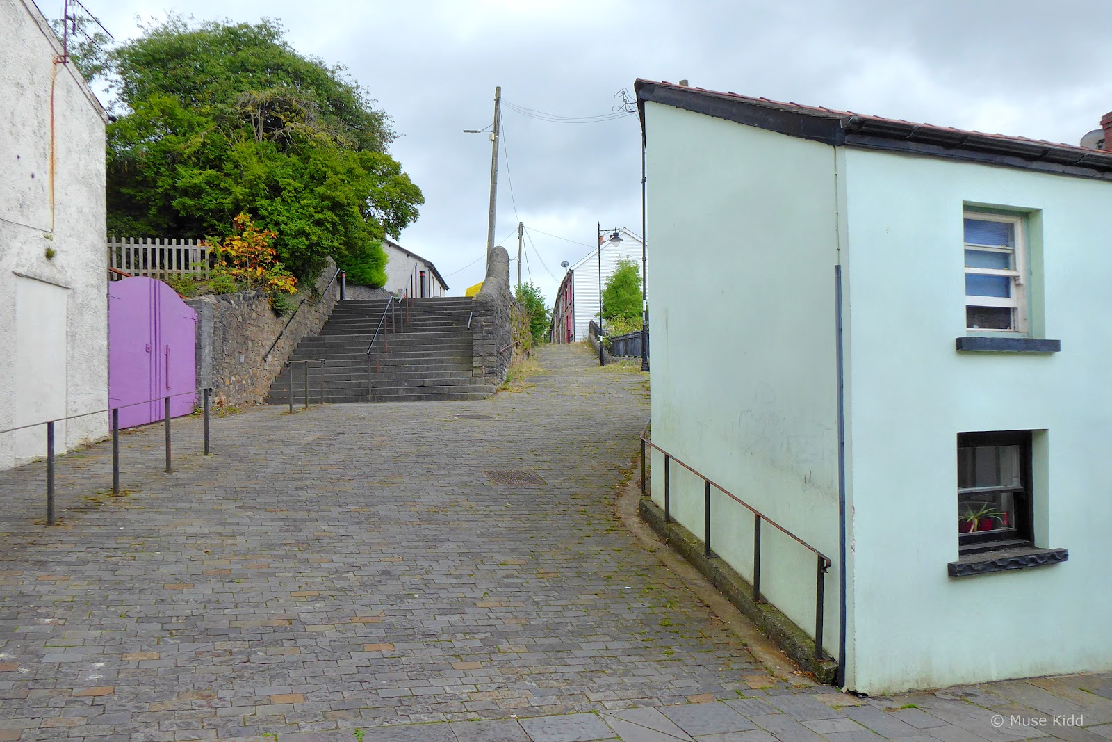
Looking back down Broad Street from the junction with Lion Street (Boot Lane is visible on the left side in the photo below.)

At the top of Boot Lane you will merge onto Duke Street. Boot Lane is quite short and ends at a pedestrian crossing over to Hill Street (shown below).

Cross over and turn left, heading up Hill Street until you reach the Cambrian Inn (shown on right in image below). Directly across from the Cambrian Inn is Butterflies Bar & Kitchen (Blaenavon's hidden gem).

Turn right just past the Cambrian Inn onto Bryn Terrace and continue to the junction with Ton-Mawr Street. (Note: This is also Llanover Road, shown below.)

At the junction with Tom-Mawr Street, crossover through the pedestrian crossing and continue heading straight on Llanover Road.


The housing estate is rather small and ends at a cattle crossing as Llanover Road continues up the hill at a slight angle. Congratulations! You've made it through Blaeavon.

The road becomes quite scenic for the next few miles and the route is easy to follow now, so despite the slight incline, you can relax and enjoy the ride.


Nearing the top of the hill the views begin to open up on your right overlooking the Afon Lwyd Valley.
Note: You will pass a large tree on your right with a small bench. Lower down the hillside is an unmarked stone and cross. I've yet to find anyone who knows what this marker commemorates?


You will soon crest the hill of Mynydd y Garn-fawr and the natural divider between Torfaen and Monmouthshire counties. Not only does this location provide spectacular views across two valleys, but this area holds significant archaeological interest. Off to the left on a slightly higher ridge sits an Early Bronze Age cairn.


As you begin to descend the hill you will pass a rough dry stone wall. This original boundary marker is thought to date back to the Early Middle Ages.


The road then veers left and begins descending a very steep hill.


After .25 mile, the road levels briefly as you pass the lovely Hill Farm and also site of Trenosa Glamping.


Leaving Hill Farm the road again begins to drop steeply, but don't let it rip too much, be sure to look out over the valley to your right. The views are spectacular.
Note: You should see a bright white building on the far hillside. This is the famous The Goose & Cuckoo Inn, established to avoid the temperance movement of the 1800's and far enough away from Lady Llanover's reach.


This is the section indictated in black on the map. It's very steep (+16% decline) and it's surprsingly long. Also show caution, there is very little room to pass if you meet a car coming up the road.


When I stopped to photograph the road, I couldn't help but get off my bike to walk over to the field on the right. The views are worth it.


The road levels off briefly again and here the valley opens up on your left. It too is quite scenic with wide rolling pastures.


With one last fast descent you reach the junction with the very busy A4042 in Llanover (show caution). Cross the road and continue down the small lane.
Note: Just before the junction, you'll pass a small white and grey cottage. This is part of the Llanover Estate which I'll briefly describe just ahead.)


Most the land on the right-side of this lane is part of the Llanover Estate & Gardens. Dating back to the late 18th century, the 27-acre property is still privately owned and very much a vibrant, working estate.


You'll cycle along this rolling lane for a couple of miles before reaching the junction with Old Abergavenny Road.


The estate maintains a flock of Welsh Black Mountain sheep. The bloodline dates back to the early 1800's when pedigree stock was brought here from West Wales. Read more...


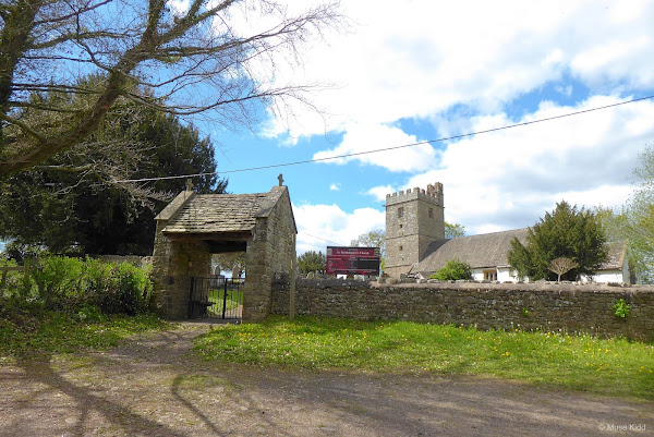
Squeezed between the River Usk and the rolling pastures of Llanover Estate, St Bartholomew church contains the elaborate grave of Benjamin Hall, 1st Baron Llanover and his wife, Augusta Hall, Baroness Llanover.

Baron Llanover oversaw the rebuilding of the Houses of Parliament in 1859, including installation of the 15-ton bell in the clock tower. The Baron was quite a tall man and many attribute the clock's name; "Big Ben" to him.
Lady Llanover was quite a character in her own right and is remembered widely as revitalising the Welsh language and creating the "so-called" traditional Welsh costume. Additionally, she was a fervent supporter of the temperance movement in Wales and subsequently forced all public houses on her lands to close.
Lady Llanover was quite a character in her own right and is remembered widely as revitalising the Welsh language and creating the "so-called" traditional Welsh costume. Additionally, she was a fervent supporter of the temperance movement in Wales and subsequently forced all public houses on her lands to close.
Remember The Goose & Cuckoo Inn mentioned earlier? This pub takes great pride in their history and avoidance of the temperance movement of the mid-1800's.
Llanover Estate owned cottages can be spotted thoughout the area by their distinctive bright white with grey trim paint schemes. Tidy!


This is typical Welsh countryside and the character of Vale of Usk is at it's finest.

After a couple of miles you reach Abergavenny Road. Turn right and head up toward Llanover House itself. Behind the rough stone wall at the edge of the lane you can see a second wall, much taller and made of brick... that is their vegetable garden. Peasants KEEP OUT!

A short distance up the lane you can peek over the smaller stone wall to see into the famous Llanover Gardens. Be sure to watch this stunning video footage of Llanover Gardens.

Continuing up Old Abergavenny Road you will soon reach the A4042 again. (Looking to your right you can see the decorative entrance to the Llanover Estate.) Cross diagonally over the A4042 to continue up Abergavenny Road.

It's a fairly steady climb for about .5 mile(s), but it soon levels off as you pass over the Monmouthshire & Brecon Canal.

Hidden deep beneath a thick canopy of trees, the sunlight can hardly reach the murky canal below. Note the Swiss Family Robinson style walkway on the left which leads to a treehouse-like gazebo.


Continue up Abergavenny Road for a couple of miles of easy, yet rolling cycling. Enjoy.


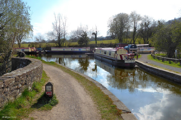
Monmouthshire & Brecon Canal
Just after two miles and a short, yet rather steep descent, the roads turns as it crosses over the canal again. On your right will be an entrance onto NCN Route 49 which follows alongside the Monmouthsire & Brecon Canal.

Sit back and relax as you've got a perfectly flat, traffic-free ride for the next 3.5 miles to the boatyard at Pontymoile Basin.


People are often walking along the path and the bridges can be quite low, so be sure to ring your bell or give a shout to let anyone know you're coming along.


Soon you will come to Goytre Wharf.
Goytre Wharf hosts a number of activities, from longboat hire, canoe hire, fishing, and yes, you can even rent a bike! Across the canal there's a lovely cafe with public toilets and there are plenty of picnic tables scattered throughout the area.
The canal dates back to the early 1700's, whilst the wharf and adjoining restored lime kilns are over 250 years old. Read more...
The canal dates back to the early 1700's, whilst the wharf and adjoining restored lime kilns are over 250 years old. Read more...


NCN Route 49 is brilliant. The path along the canal is suitable for all ages and every skill level. It is simply a "must ride" for every cyclist.


The exit back to the road leading to the Pontypool/New Inn Train Station is just on the other side of bridge number 53.

As you exit the bridge you should recognize Pontymoile Basin ahead of you. Look to your left and you should see the path leading up to the road and to Pontypool/New Inn train station.

Congratulations! Your adventure is complete!
| ADDITIONAL DETAILS | |
| Blaenavon Ramble |
Getting to the start: Exit the Pontypool / New Inn Train Station on the short service road, then turn right onto "The Highway" (not the best name for a road, it's just a minor B road with two wide lanes). You'll travel less than .25 of a mile before exiting onto a small path leading down onto the Monmouthshire & Brecon Canal.
| ▲ Back to |
| ROUTE COLOUR KEY: | Traffic-free | Shared Use | Quiet Road | Steep Hill |
Returning to Pontypool / New Inn Train Station: Simply return from the M & B Canal (NCN Route 49) back the way you came. Exit the canal along the small path onto "The Highway", turn right and travel approximately .25 mile, then turn left up the service road to the train station.
Before you leave: It's worthwhile to do a little research before you make your trip to learn about the areas you'll be passing through so that you can plan your time. There are several locations with facilities, but they're some distance apart.
You & your equipment: You should bring plenty of snacks and drinks to last the day. It is highly recommended that you also carry suitable rain gear (This is Wales!) Always carry a spare tube, tyre patch kit (with tyre levers), a good quality multi-tool, and a reliable tyre pump. Be sure your bicycle is in top mechanical condition (do the 11-step M-test) and check yourself; are you are physically fit to ride 40 miles?
Getting there: All of the routes outlined in this section begin and end at various train stations in the Southeast Valleys of Wales — all of which can be easily reached from Cardiff Central (CDF) or Newport (South Wales) (NWP).
Parking: Because the routes begin and end at train stations, there is generally ample parking. Some locations may charge a daily or hourly fee. Of course you can load your bike up in the car, but why not reduce your carbon footprint and take the train? Plus, taking the train adds to the adventure!
Pontypool Station
Trains: Most all of the Valley train lines allow bicycles without difficulty. However, it is always best to check first and plan to travel off-peak.

Weather: This is Wales! The weather often changes quickly - especially as you reach higher elevations. Check the weather before you leave!
Maps & downloads
generously provided by:
Download: Select a map below to view a .pdf file of the route/section. You may then save or print the file for your adventure!
1. Pontypool - Brynmawr

2. Brynmawr - Pontypool

Find a Route

Visit the Sustrans website for more details and routes of the National Cycle Network.

NCN Route 466
Ebbw Fawr Valley
Ebbw Fawr Valley
Pontypool - Llanhilleth
- joins NCN Route 465
- joins NCN Route 465

NCN Route 465
Ebbw Fach Valley
Ebbw Fach Valley
Llanhilleth - Brynmawr
- joins NCN Route 46
- joins NCN Route 46

NCN Route 46
Brynmawr
Brynmawr
Leaves town on high ridge
- joins NCN Route 492
- joins NCN Route 492

NCN Route 492
Afon Llwyd Valley
Afon Llwyd Valley
High ridge to Blaenavon
- exits onto roadway
- exits onto roadway

NCN Route 49
M&B Canal
M&B Canal
Mamhilad - Pontymoile
- exits onto roadway
- exits onto roadway
Note to Readers: Examine the provided online maps closely to understand conditions prior to your ride. Each route listed includes a colour-coded map indicating specific terrain along with the distance(s). When considering difficulty; remember elevations +/- gains are equally important to distances. Printing the included .pdf maps and/or downloading the GPS file is highly recommeded.
Disclaimer of Liability. Bike Wales™ and everyone associated with this website/blog accept no responsibility for the conditions of the routes discussed. These are simply "suggested" routes of the National Cycle Network that the reader may choose to follow. Any action(s) taken from reading the content herein, is solely the responsibility of those involved.