From the lush Rhymney Valley through historic Darran Valley, across the panoramic high ridge of Gelligroes Commons, this ride finally returns via Parc Taf Bargoed and Penalta Park for a short, yet stunning adventure.

Adventure Classic
Fochriw Highlands
Locations include: Hengoed, Bargoed, and Fochriw
Total Distance: 22.9 miles / 36.85 kilometres (round-trip)
Elevation Change: + 1,479 / - 1,474 ft
Approximate Travel Time: 3 - 4 hours
Ride Level: Intermediate / Advanced
This route begins and ends at the Hengoed Train Station. Approximately 50% of the route is on traffic-free walking & cycling paths which are clearly sign-posted. However, some sections which follow roads are NOT sign posted and require special attention.
The route starts deep in the Rhymney Valley passing through the nature reserve at Bargoed Woodland Park on NCN Route 468. The ride then splits off onto NCN Route 469 to continue north through Darran Valley to Parc Cwm Darran. At Fochriw the route joins the road as it climbs to the upper moors for a lengthy ride back along the high ridge of Gelligaer Common providing scenic views across both the Darran and Taf Bargoed Valleys.
Dropping down from Gelligaer Common, the ride then joins NCN Route 476 as it passes through Parc Taf Bargoed and finally joining NCN Route 47 in Trelewis to contiue back through Parc Penalta for a surprisingly flat and easy return to Hengoed Train Station.
The overall route is fairly short, but it does offer challenges. It's a great little adventure for those who wish to gain more experience across a varied terrain or for experienced riders who want an assortment of scenic terrain in a short package.
| ROUTE COLOUR KEY: | Traffic-free | Quiet Road | Shared Use | Steep Hill |
Table of Contents
PART ONE | Hengoed Train Station to Pengam
2.3 miles; mostly all on roads.
PART TWO | Pengam to Fochriw
7.4 miles; mostly all traffic-free.
PART THREE | Fochriw to UK Climbing Centre
7.6 miles; all on quiet roads. (+371 ft / -989 ft)
PART FOUR | UK Climbing Centre to Hengoed
5.5 miles; all traffic-free. (+229 ft / -338 ft)
ADDITIONAL DETAILS
Relevant links, individual NCN Route maps, an overall map for download, as well as local train information and weather links.
Part One
 |
Hengoed Train Station to Pengam |
Distance: 2.3 mi. / 3.7 km
Elevation: +109 ft / -98 ft
Elevation: +109 ft / -98 ft
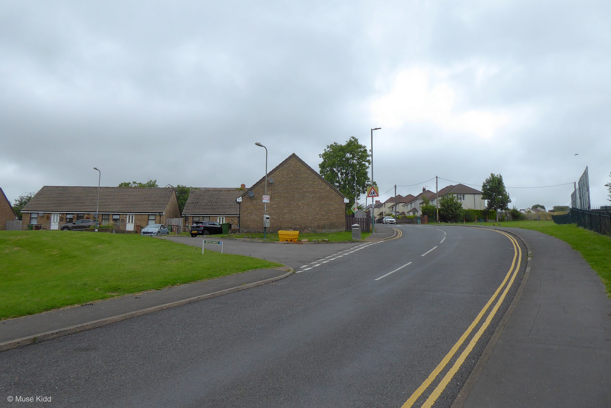
From the Hengoed Train Station, NCN Route 47 is easy to find as it runs between the car park and the Hengoed Community Centre. Begin your ride heading east across the Hengoed Viaduct.
Completed in 1858, the viaduct consists of 16 arches spanning a length of 852 feet (260 m) and rises high above the Rhymney River to just over 120 feet (37 m). The viaduct operated first for the Newport, Abergavenny & Hereford Railway, then later the Great Western Railway before closing to both passenger and goods travel in 1964. And even though you've just started, the views looking out across the Rhymney valley are worthy of a brief stop.
Completed in 1858, the viaduct consists of 16 arches spanning a length of 852 feet (260 m) and rises high above the Rhymney River to just over 120 feet (37 m). The viaduct operated first for the Newport, Abergavenny & Hereford Railway, then later the Great Western Railway before closing to both passenger and goods travel in 1964. And even though you've just started, the views looking out across the Rhymney valley are worthy of a brief stop.
| ▲ Back to |


At the end of the viaduct is the notable sculpture by Andy Hazell; "The Wheel of Drams". Often chosen as a photographic landmark, this is one of the largest scuptures found along the cycle paths in Wales.
Turn right off the main cycle path and drop down the short zig-zag onto the shared-use pavement which loops around the Angel Inn and onto Victoria Road.
Turn right off the main cycle path and drop down the short zig-zag onto the shared-use pavement which loops around the Angel Inn and onto Victoria Road.

Next you will merge onto Victoria Road and continue straight under the viaduct for approximately 1.5 miles into Fleur de Lis. The road is quite narrow at first and cars may have difficulty passing as there are several small hills and blind curves, so show caution.
Note: The route is not sign-posted from Hengoed along Victoria Road to Fleur de Lis.


Follow the High Street through Fleur de Lis to Ford Road. Turn left, then take an immediate right onto a small service lane which heads past a retirement home and several new houses. At the end of the lane you will see the entrance to a cycle path heading into the woods.

The path exits shortly onto a narrow street passing through a very small housing estate. At the next junction (A469) turn left and then immediately right into the car park for the Bargoed Woodland Park. The entrance to NCN Route 468 is at the back of the car park.

Part Two
| NCN | 468 | 469 |  |
Pengam to Fochriw |
Distance: 7.4 mi. / 11.90 km
Elevation: +817 ft / -105 ft
Elevation: +817 ft / -105 ft
Follow the signs for NCN Route 468 through Bargoed Woodland Park as it winds it's way back and forth over the Rhymney River for approximately 1.6 miles. There are several short, but somewhat steep decents and several equally short, but quite steep climbs before exiting at the roundabout by Morrison's Petrol Station. The route will then contiue as a shared-use path up to and through Bargoed.
From Bargoed, you'll enter NCN Route 469 and begin the steady, but easy climb through Darren Valley up to Fochriw. Nearing the top of the ride, Parc Cwm Darran provides a a great place for a break with a visitor centre, cafe and toilets (seasonal). The route is clearly marked, easy to follow, and traffic-free for 5 miles. The very last section enters the High Street at Fochriw.
From Bargoed, you'll enter NCN Route 469 and begin the steady, but easy climb through Darren Valley up to Fochriw. Nearing the top of the ride, Parc Cwm Darran provides a a great place for a break with a visitor centre, cafe and toilets (seasonal). The route is clearly marked, easy to follow, and traffic-free for 5 miles. The very last section enters the High Street at Fochriw.
| ▲ Back to |

As you begin, pay close attention for the NCN Route 468 signs; there are many paths which veer off and crisscross the main route. The first turn is less than .25 mile ahead at the top of a short rise and the marker is not the easiest to spot. Also note that this is a popular park for children and dog walkers, so show caution as there are some narrow sections as well as bridge crossings.

Just after you make the first turn you'll soon cross a very unusual bridge which zig-zags high above the Rhymney River. It' s easy to be distracted by the bridge itself, but I suggest slowing down and just looking over the sides. It's a lovely view and surprising to see the depth of the gorge.


On the opposite side of the bridge there is a short and moderately steep ascent to the top of the adjoing hill. The path is narrow so show caution for both pedestrians and other cyclists who may be descending.

As you come out from the under the cover of the trees, there is dramatic view of the bridge above you. Dropping under the road on a short decent, the route continues along a gentle glide by the river's edge.


This section of the Rhymney River is outstanding. Take note of the overhanging trees and flowers. Herons are often stalking about the shallows and Kingfishers can be seen darting amoungst the low-hanging branches.


The valley then slowly narrows as you approach a small bridge where you will then cross back over the river. Take your time. Look around. Take some photos.


Unfortunately, all this comes to an abrupt end just after a short but very steep climb out of the park. You'll pass under the road again and once through the gates you'll head up toward a very busy roundabout.

You will need to show extreme caution as you navigate around the Morrison's Petrol Station. Cars exiting the station do not look for cyclists and cars often enter the station at a high rate of speed as they are coming off the roundabout.

NCN Route 468 contiues as a shared-use path for the next .25 mile along side the very busy Station Road (A469) to the next roundabout at the Bargoed bus station.

Passing the bus station on your left, continue straight through the roundabout and up the hill, passing the town centre (again on your left) and through a second smaller roundabout.

Continue straight down the narrow road between rows of houses on your left and the train tracks to your right. At the bottom of the hill you'll see the entrance to NCN Route 469 entering the woods.

NCN Route 469 immediately enters the woods and continues as a lovely traffic-free cycle path for 4.5 miles all the way up Darran Valley to Fochriw.
Note: Sustrans does not mention NCN Route 469 on their website for some unknown reason? While the route itself is clearly marked as such, Sustrans has, oddly enough, chosen to only refer to the route as "Darran Valley".


Just up the path a short distance you will come across rather non-descript bridge. However, off to the right is a marker that makes this bridge a bit more interesting. 2,000 years ago the Roman army fought the Silurians in this area; Caradoc was the Silurian leader. ► Read more.


It's a short walk down through the brush along a narrow path, but it's worth it. It's dark and damp and the water is really loud as it's crashing over the rocks under the bridge.


When I first wandered through here I thought to myself; "You'd never know that this is here unless you explored... which is a perfect synopsis of Wales."


As much as the rivers carved out these valleys for millennia, it's important to remember the miners who gave their lives and also transformed this landscape. In 1909 there was an explosion in the Darran Valley Mine which killed 27 men, included three rescuers. ► Read more.


Continuing up the path, there is a road crossing at the sleepy village of Deri. For some unknown reason the next section is not shown on many online maps... which is surprising since you can clearly see it ahead and there are two very interesting bridges to investigate. The Ogilvie Halt footbridges are Grade II listed buildings dating back to 1871. ► Read more.


Even at the slow pace riding a bicycle provides, it's important to get off your bike sometimes to just poke around. The views can be surprising.

No drones were used in the capturing of these images!


You'll come to a small road crossing again, but the traffic-free route continues on into the woods. As you progress, you'll begin to see picnic tables and benches appear as you approach a large pond on your right.


Oglvie Lake sits at the heart of Parc Cwm Darran. You'll find playground and exercise equipment, as well as a visitor centre and even a campground! Additionally, there are many lovely walking paths with picnic tables and interesting places to explore (hint: there is a large waterfall!)

It was an unusually quiet day when I took this photo, but the visitor centre is open during the Spring and Summer months which offers a cafe, exhibition area, and toilets. And for even more adventure, there's a campground! ► Read more.


Leaving Parc Cwm Darran along the cycle path, you then enter the Cwmllwydrew Meadows Nature Reserve. Local sheep and cattle graze the meadows as part of a traditional management program designed to promote the growth of native grasses and wildflowers.


The route now drops down to the bottom of the valley again as it follows closely along the Darran River (which seems to to be little more than a brook).

The meadows appear more wild with the grasses nearly hiding the sheep. The far ridge in the distance is where we'll be heading soon!


NCN Route 469 ends at the entrance to the village of Fochriw. Pass through the gates and continue up the lane through the housing estate for .4 mile to where you will see a path following along side a play area which ends shortly at the High Street.


To your left is an interesting news agent, which too, will be your last opportunity for snacks or drinks for the next 7.5 miles. It's also worthwhile to take a look at the historical photos they have posted on the outside. It's quite surprising to see all the hustle & bustle this area once had back in the days when the railroad came through this now sleepy village.

Re-enter the pavement, turn right and begin the short, but quite steep climb up past the the Fochriw Community Centre and school. (see: the black section highlighted in the map shown at the beginning...) Surprisingly, this will be the steepest and longest climb of the ride. Also, if the school kids are about, you're sure to get quite a cheer as you slowly crank up the hill!
Part Three
ON ROAD |
Fochriw to UK Climbing Centre |
Distance: 7.5 mi. / 12.07 km
Elevation: +371 ft / -980 ft
Elevation: +371 ft / -980 ft
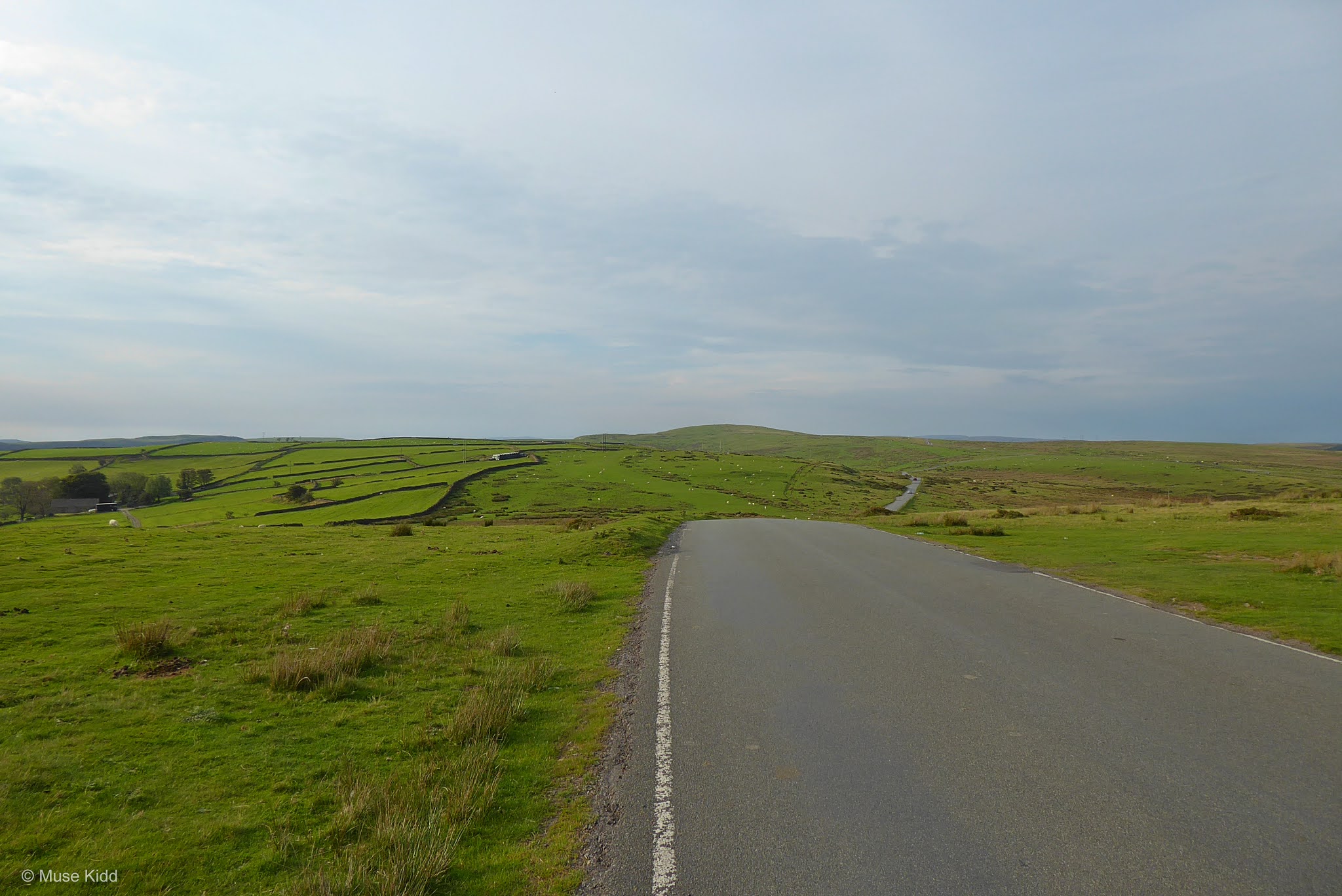
Now the real fun begins... At the top of the hill, turn left and continue north (across the cattle gate) and out into the wide open expanse. This area doesn't have a particular name that I can find, so I've taken to calling it the Fochriw Highlands.
Be prepared for strong wind. On the day that I shot these photos the clouds were racing past and the wind was howling. It was fantastic. But also, it was quite difficult to straddle the bike and hold up my camera!
Be prepared for strong wind. On the day that I shot these photos the clouds were racing past and the wind was howling. It was fantastic. But also, it was quite difficult to straddle the bike and hold up my camera!
| ▲ Back to |


So close, but it feels so far away. This section climbs steadily for just a mile before ending at the only road junction. Be sure to stop and look back. Take your time. Enjoy.


At the top of the road, turn left and begin cycling southeast toward the top of the ridge.


There can be a bit more traffic along this section, but visability is very good. Cars can see and be seen from quite a distance.


It's okay to stop... in fact, I recommend it. Look around. Listen. You can hear for miles. There's tiny little Fochriw below you. Look closely and you'll see from where you just came.


At the next junction, bear right and continue heading out across the ridge. It's the natural route to follow. Sit back and relax... this is what cycling in Wales is all about.

Travel another mile along the ridge to the next junction and keep going straight... there's more to see up here.


Occasionally you might encounter a car, perhaps you might see another lone cyclist, but sheep, cattle, and wild horses now graze where once the Romans marched. On your left you'll pass a large stone marker. Stop. Look around. How many men have stood looking across this ridge? ► Read more.

Back on the road, in the distance you will see a slight hill (.5 mile ahead) at the top of this hill the road forks. The road going straight is slightly more narrow and rougher, so bear right and continue on the main road.

For the next mile or so the road rolls up and down the ridge. You will pass three smaller roads turning off to your right. (Count them!) Because at the fourth small road you will need to turn right. You will see that this road leads you down into the adjoining valley.

A second even smaller road is just ahead .25 mile. Turn right to continue down this very steeproad that wraps around the hillside for the next 1.25 mile. It is stunning. Enjoy!
Note: You can find this particular section of the route highlighted in black on the map embeded above.


Turn left at the bottom of the hill onto Oakland Street (B4255) heading away from Bedlinog. Travel .5 mile and turn right into the Rock UK Climbing Centre.


Part Four
| NCN | 476 | 47 | |
UK Climbing Centre to Hengoed |
Distance: 5.7 mi. / 9.17 km
Elevation: +232 ft / -355 ft
Elevation: +232 ft / -355 ft
The Rock UK Climbing Centre has an extensive list of activities for the whole family, as well as a lovely cafe and pubilc toilets. The Centre even offers accomodations, but the days and hours it is open are varied across the school year. It would be advisable to check beforehand if you wish to make a visit.
For now, you can rest and relax with the knowledge that the remainder of the route is practically all flat as you'll make your way across NCN Route 476 as it passes through Parc Taf Bargoed and finally joining NCN Route 47 in Trelewis to contiue back through Parc Penalta to the Hengoed Train Station.
For now, you can rest and relax with the knowledge that the remainder of the route is practically all flat as you'll make your way across NCN Route 476 as it passes through Parc Taf Bargoed and finally joining NCN Route 47 in Trelewis to contiue back through Parc Penalta to the Hengoed Train Station.
| ▲ Back to |
 Photo courtesy of UK Climbing Centre
Follow the road around the left of the Climbing Centre to find the entrance to the cycle path on the far side of the car park. Although it is not well marked at first, this is in fact NCN Route 476.
Note: You'll find that Sustrans only lists NCN Route 476 as part of their Three Parks Trail.


The path surface is a fine gravel at first, but shortly becomes paved as you enter Parc Taf Bargoed. It is worthwhile noting that on your left is one of the largest man-made reedbeds in all of Europe. Built between 1999 and 2001, these natural filters remove iron from the water that flows from the old mines which was polluting the park lakes. ► Read more.


Entering Parc Taf Bargoed it is hard to imagine that this was once the site of a three large coal colleries. Through a massive reclamation scheme which began in 1999, 140 hectares were transformed into the lovely park you see today and awarding this area the national Green Flag status.

There is a fascinating bit of reading with photos from when the mines were in operation which are shocking to compare with what is here today. You can read more at the Facebook page: #landscapetransformed.

And yes, this is the perfect spot for a picnic. During the summer months the public toilets are open and there is a small cafe serving light lunch fare as well.


The route merges with NCN Route 47 as you leave the park. The bridge to your right crosses over the Taf Bargoed River and a unique set of waterfalls. This system of water-steps provides hydro-electricity to the surrounding community and helps fund the park itself. How brilliant is that? ► Read more.


You'll follow NCN Route 47 for the next four miles back to Hengoed Train Station. It's virtually flat and quite unique for this part of Wales.


The path is well-paved, completely traffic-free, and very popular. You'll often find walkers with dogs and parents with their kids totering about on new bikes. Take your time, you're almost done.


After a couple of miles you'll enter Parc Penalta and the landscape widens. This is a popular spot for picnicing and exploring; the most notable landmark being Sultan the Pit Pony.
Note: You'll be cycling south of the sculpture. To view Sultan, you'll need to exit the cycle route and climb a rough gravel track for just over .5 mile to the viewing platform. (See: image below.)


Once you leave the parc there is a series of short zig-zags and very short, but mild climb followed by the only road crossing.

From there it is roughly .5 mile to the Hengoed Train Station where your adventure began.


Congratulations! You've made it.
Additional Details
Fochriw Highlands
Getting there: All of the routes outlined here begin and end at various train stations in the Southeast Valleys of Wales — all of which can be easily reached from Cardiff Central Station. Of course you can load your bke up in the car, but why not reduce your carbon footprint and take the train? Plus, it adds to the adventure!
Parking: The routes begin and end at either train stations or parks, so there is generally ample parking. Some locations may charge a daily or hourly fee.
Parking: The routes begin and end at either train stations or parks, so there is generally ample parking. Some locations may charge a daily or hourly fee.
Hengoed Station
Trains: Most all of the Valley train lines allow bicycles without difficulty. However, it is always best to check first and plan to travel off-peak.

Weather: This is Wales! The weather often changes quickly - especially as you reach higher elevations. Check the weather before you leave!
Map & Cue Sheet
provided by:
Download: Click below to view a .pdf file of the route and cue sheet. You may then print the file for your adventure!

NEW! Click the link below to visit the Ride with GPS website to download the entire route for your iPhone, Andorid, Garmin, or other device! ► Send to Device
Find a Route

The following routes of the National Cycle Network were incorproated either fully or in part. Click the links below to read more at the Sustrans website.

NCN Route 468
Rhymney Valley
Rhymney Valley
Pengam - Bargoed
- joins NCN Route 469
- joins NCN Route 469

NCN Route 469
Darran Valley
Darran Valley
Bargoed - Fochriw

NCN Route 476
Taf Bargoed Valley
Taf Bargoed Valley
Cwm Bargoed - Trelewis
- joins NCN Route 47
- joins NCN Route 47

NCN Route 47
Trelewis - Hengoed
Note to Readers: Examine the provided online maps closely to understand conditions prior to your ride. Each route listed includes a colour-coded map indicating specific terrain along with the distance(s). When considering difficulty; remember elevations +/- gains are equally important to distances. Printing the included .pdf maps and/or downloading the GPS file is highly recommeded.
Disclaimer of Liability. Bike Wales™ and everyone associated with this website/blog accept no responsibility for the conditions of the routes discussed. These are simply "suggested" routes of the National Cycle Network that the reader may choose to follow. Any action(s) taken from reading the content herein, is solely the responsibility of those involved.