Raglan Classic
This lovely route heads north along the Monmouthshire & Brecon Canal from Newport to Pontymoile Boat Basin and then on to Goytre. From there you'll wind your way along quiet lanes through the Vale of Usk to Raglan before returning back to Newport.

OVERVIEW
Raglan Classic
Locations include: Newport, Pontymoile, Goytre, and Raglan
Total Distance: 43.9 mi. / 70.65 km (round-trip)
Elevation Change: + 2,178 / - 2,153 ft
Approximate Travel Time: 6 - 8 hours
Ride Level: Advanced
Total Distance: 43.9 mi. / 70.65 km (round-trip)
Elevation Change: + 2,178 / - 2,153 ft
Approximate Travel Time: 6 - 8 hours
Ride Level: Advanced
Pack your lunch, get your bike tuned, and come along for one of the most scenic rides through the heart of Southeast Wales. This ride doesn't take you to historic landmarks or sightseeing ruined castles. Just like the name suggests; this is a ramble. Riders are encouraged to take their time and make the most of the day. This route is about cycling slowly along quiet country lanes, enjoying the fresh country air, and looking at the wonderful landscapes of Wales.
The overall route is fairly straight-forward, yet it is designed for experienced cyclists. It's not exceptionally difficult, but it does offer a few challenges; there are several short but sharp climbs, a couple of moderately busy roads to follow briefly, and two busy roundabouts to navigate. It's an excellent adventure for cyclists confident with their skills, using equipment suitable for long rides, and individuals physically capable to spend all day on their bikes cycling nearly 50 miles.
The route begins and ends on the National Cycle Network; specifically at the junction of NCN Route 47 and NCN Route 49 in Newport. Maps providing details from the Newport Train Station are listed at the end of this guide.
The first 12.7 miles are traffic-free as you follow NCN Route 49 from Newport to just outside Goytre. This route also happens to be the towpath of the Monmouthshire & Brecon Canal. From Goytre you will cycle the next 27.3 miles along quiet lanes, winding your way through the Vale of Usk to Raglan and then back down to Caerleon. Whilst the remaining 3.9 miles are again traffic-free as you join NCN Route 88 for the final return back into Newport.
The map shown above is divided into four parts to assist with navigation. Additionally, each part has its own specific map which link together to provide the complete route. Downloadable versions of each section are available at the end of this guide in the ADDITIONAL DETAILS.
Table of Contents
You may jump directly to either section of the route by clicking the section title below. Additionally, at the end of each section you will find links to return to this TOC.

PART ONE
Fantastic traffic-free cycling on NCN Route 49 along the Monmouthshire & Brecon Canal for 7.7 miles. Some road crossings through Cwmbran, as well as a few moderate climbs through Five Locks.

PART TWO
Continue along the M&B Canal as NCN Route 49 moves deeper into the Welsh back-country for 5.5 miles. Road crossings are replaced with small bridge underpasses; suburban housing with rolling countryside.

PART THREE
Enter the heart of the Vale of Usk on The Great Oak Loop. Explore nearly 12 miles of quiet lanes which meander across sprawling farmland and rich landscapes before entering the town of Raglan.

PART FOUR
Quiet lanes continue along Lord Raglan's Bugatti and Mouseman's Gate as you weave your way back to Caerleon for 15.2 miles. Join NCN Route 88 for the last 4 miles traffic-free into Newport.
Relevant links and route maps are provided for print or download. Additionally, you'll find links to train station(s) and local weather.
PART ONE
| NCN | 49 |  |
Newport to Pontymoile |
Location(s) include: Monmouthshire & Brecon Canal
Total Distance: .7 mi. /12.39 km
Elevation Change: +449 ft / -117 ft
Total Distance: .7 mi. /12.39 km
Elevation Change: +449 ft / -117 ft
The beginning of the ride follows NCN Route 49 along the main branch of the Monmouthshire & Brecon Canal from Newport to Pontymoile. The route is mostly paved along the towpath and traffic-free; however, there are a number of roads to be crossed.
There a many short humps as you pass the locks along the canal, especially at Five Locks. As you pass through the town of Cwmbran the route veers from alongside the canal briefly as it passes through a small housing estate and a busy roundabout.
This section starts at the southernmost end of the route on the outskirts of Newport where the Crumlin Arm of the Monmouthshire & Brecon Canal branches off toward 14 Locks (NCN Route 47) whilst the main branch of the canal heads toward Cwmbran.
There are no facilities for the first 3 miles; however, there are numerous locations for food or facilities as the route then passes through Cwmbran, Sebastopol, and Griffithstown. Two significant points of interest are: Evans Cycles in Cwmbran and The Open Hearth in Griffithstown (a lovely pub to stop for lunch!)
| ▲ Back to |
| ROUTE COLOUR KEY: | Traffic-free | Shared Use | Quiet Road | Steep Hill |
Let's get going!
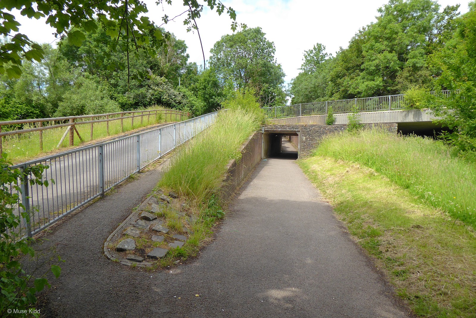
It is not the most auspicious start, but NCN Route 49 begins just by the M4 motorway. In fact, the path heads directly under the road! It's fairly dark, generally very wet, but fortunately not very long. Once you exit on the other side, the route opens up nicely and you quickly leave behind the roar of the road and busy traffic.


From here the canal path begins a series of long flat stretches punctuated by short humps which climb either along side the locks, or as shown below — over the canal itself.


You should soon start to notice the pattern; a longish flat section followed by a short hump at a canal lock and/or bridge. This pattern repeats itself for the next couple of miles.


At Ty Coch the route opens from the protection of the trees and climbs up through the newly restored locks. Over the past few years much work has been done to improve this area including new tarmac and picnic tables. Read more...

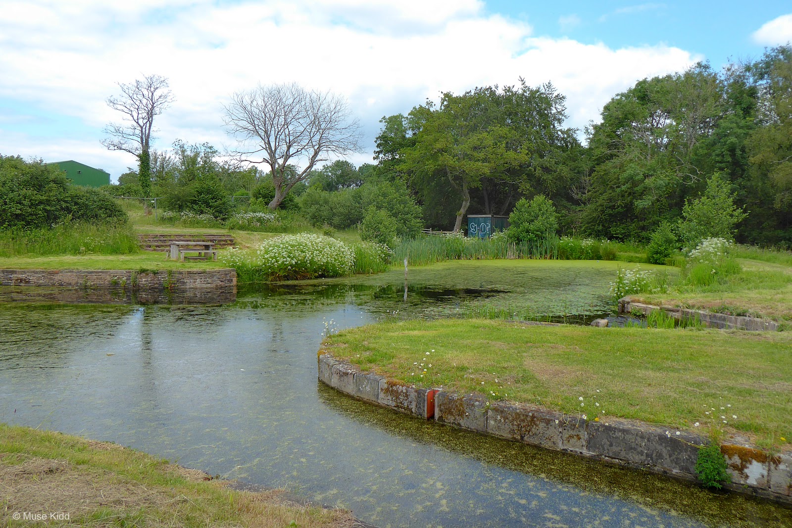
It's a surprisingly rural setting less than three miles from the city. It's a lovely place to bring the family for a perfectly safe cycling adventure and a day out.

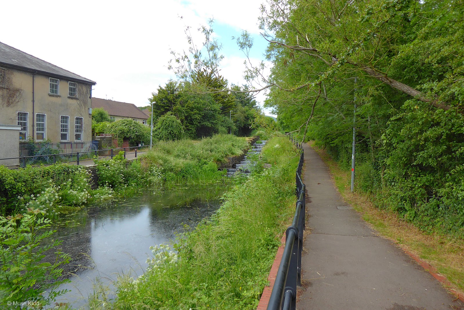
The canal path passes under the roadway at the next junction and soon enters a more surburban setting as houses begin to appear along both sides of the canal.

You'll soon cross over to the opposite side of the canal as the route continues slowly climbing toward the town of Cwmbran.

Once you reach Cwmbran their are several small, but busy roads to cross. The route changes sides again and then diverges from the canal as you weave through a small housing estate.


The path is well-marked so be sure to follow the NCN Route 49 signs closely. There are several turns both left and right to get you through the neighbourhood.

Soon you will have a very busy road crossing. Just as you exit the woods, you are faced with the junction of Greenforge Way and the A4051 roundabout. Be very careful. Surprisingly, there are no route signs, no crossing markers, and unfortuantely, no lights to assist you.

Cars coming off the roundabout are often darting across multiple lanes at a high rate of speed. It's safe to presume that drivers are not watching for pedestrians or cyclists. It is best to get off your bike and walk across this busy junction.

This is perhaps the busiest and most difficult road crossing for the entire Raglan Ramble. North of the junction is Cwmbran Retail Park and to the east is Cwmbran Centre. With over 200 retails shops combined, this area is the largest shopping complex in Southeast Wales. With that said, there is an Evans Cycles located in Cwmbran Centre (see: map).
Once on the other side, be prepared to continue walking your bike. The path is very narrow as it follows right alongside the A4051 and pedestrians are often walking between the junction and Cwmbran Retail Park.
Once on the other side, be prepared to continue walking your bike. The path is very narrow as it follows right alongside the A4051 and pedestrians are often walking between the junction and Cwmbran Retail Park.
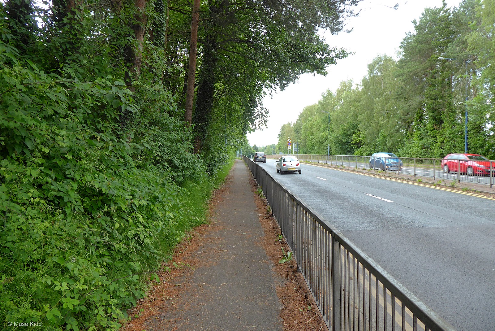

However, as you begin to pass Cwmbran Centre, the route widens and becomes very smooth as this section has been greatly improved over the past few years.


At Commercial Street you'll cross the road and begin to climb a series of five short hills. You guessed it... this is Five Locks!


This section in particular, has been greatly improved over the past few years. Yes, this is a hill, but in actuality, since it has been repaved it is much easier.


At the top of the last rise, you'll cross the road to find Five Locks Basin which is the furthest south boats can currently navigate on the Monmouthshire & Brecon Canal.

Built between 1792-99, the 70 meter Cwmbran Tunnel is actually a listed structure. Dark, overgrown, and easy to miss, I cannot imagine riding through this spooky looking tunnel on a small boat.


Not too long ago there was once a large farm here and the path was just a narrow track which was rough and often very muddy. Now it is fabulous.

Along with a newly paved path, new homes are being built along both sides of the canal and there is even the beginnings of a boat dock. This is the type of development I can appreciate. Good job Torfaen County Burough. It looks great!


Soon you will reach Crown Bridge, #48; which sits at the junction of South Street. For the next mile or so, you'll cross two more roads which are also well marked with crossing signals.


If you're feeling hungry or just care to grab a pint, The Open Hearth is a fabulous pub with seating right along the canal.

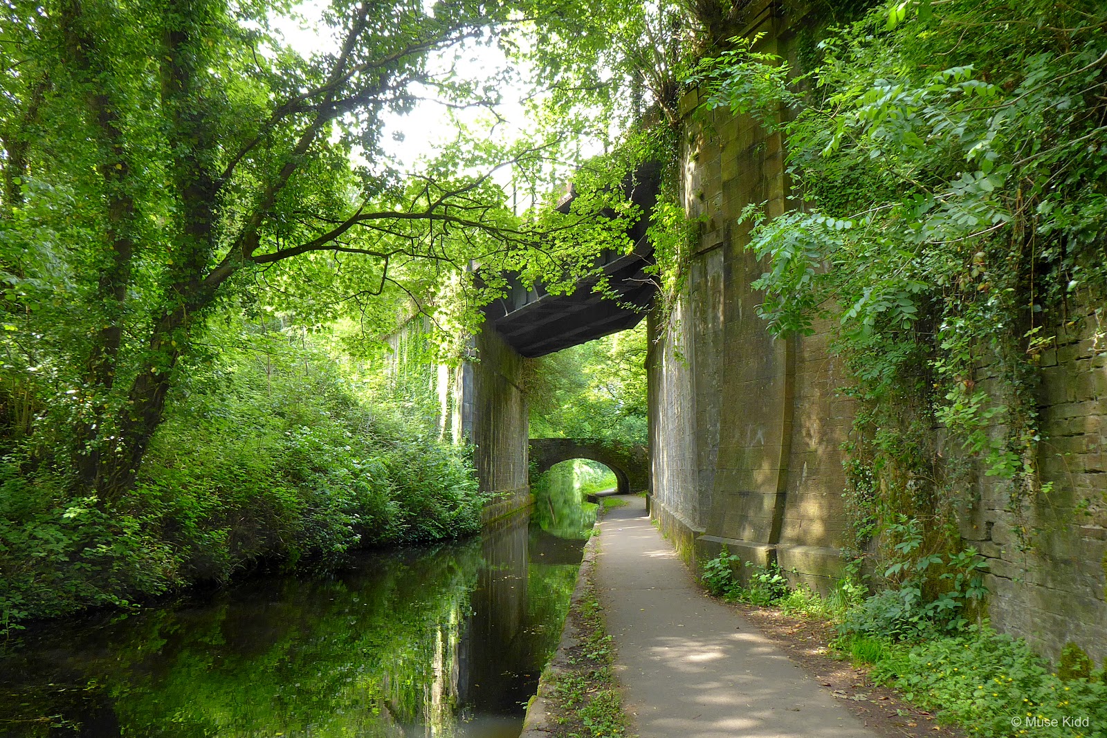
The path continues through a lovely section with houses lining both sides, but the path is quite narrow and there are often many pedestrians, so show caution.

At bridge #50, you will need to disembark your bike and walk under the very low bridge. The path is also very narrow, so be sure to give a call out or ring your bell before continuing.
Note: The ramp shown on the right in the photo below exits to the road, but there is not an ajoining ramp leading back down to the path on the opposite side. You're forced to waddle your way under the bridge. (Be sure to watch your head!)

Having passed under the bridge, the path is still quite narrow so be prepared to continue walking your bike. You can see too, that their is a high wall along your right side making it a very tight squeeze to pass other cyclists and/or walkers.

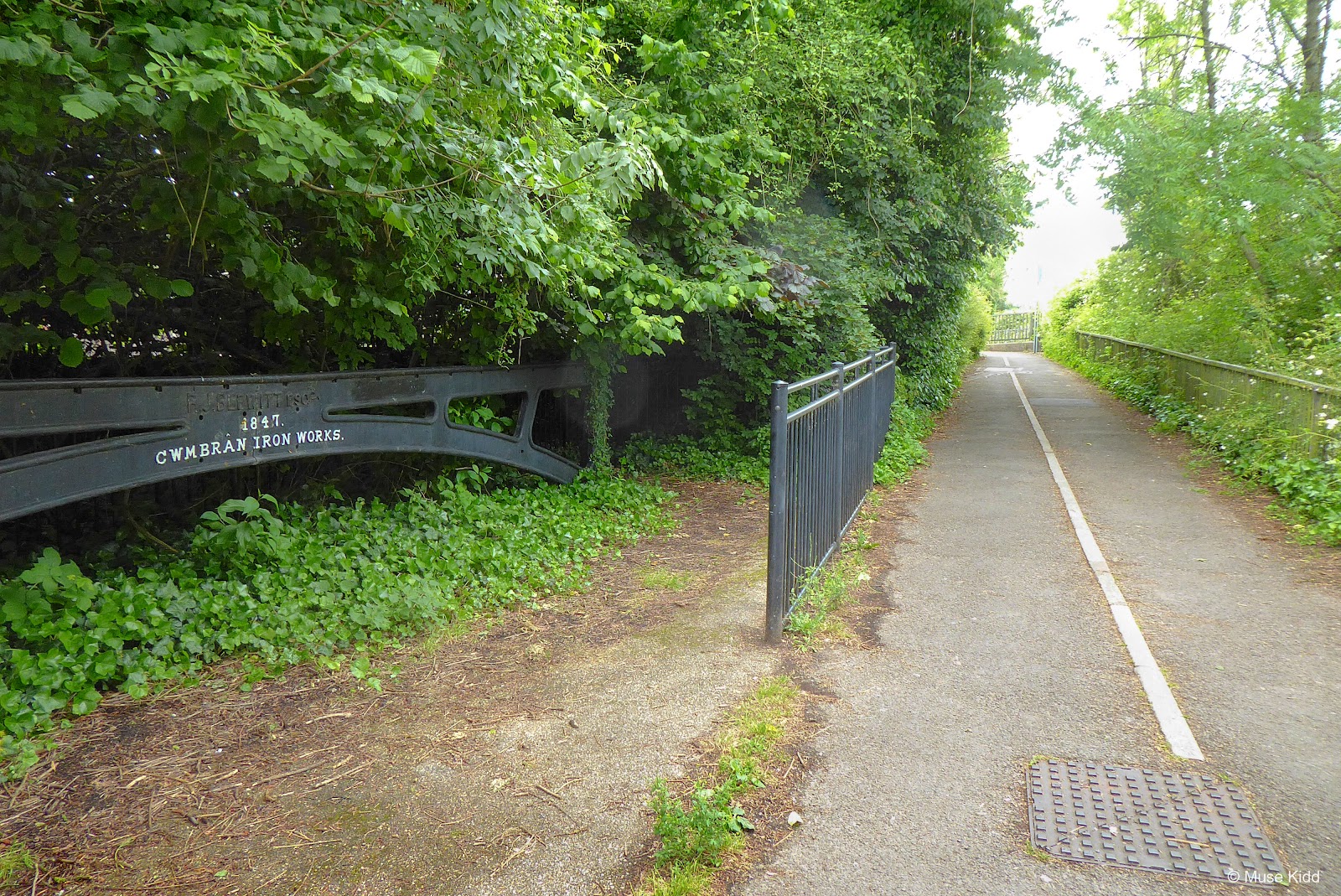
The wall ends after approximately 100 ft. and then you have your next significant junction. On your right you'll see a white sign post for NCN Route 492 which soon passes directly over NCN Route 49 in the most interesting way.


That's NCN Route 492 passing overhead on the old railline up the Afon Llwyd Valley to Blaenavon and beyond (photo above). From here it's only a short distance to reach Pontymoile Basin and the end of Part One.


Coming into Pontymoile Basin is quite charming. It's a popular starting point for many walking groups and it's not far from the Pontypool town centre or the train station.


There is a small cafe, restrooms (with limited hours), a car park, as well as picnic tables, bike stands, and even some unusual rain shelters for hikers. There will be no access to facilites for the next 5.5 miles or until the village of Goytre.
PART TWO
| NCN | 49 | |
+ | ON ROAD |
Pontymoile to Goytre |
Location(s) include: Monmouthshire & Brecon Canal and quiet lanes
Total Distance: 5.5 mi. / 8.85 km
Elevation Change: +255 ft / -312 ft
Total Distance: 5.5 mi. / 8.85 km
Elevation Change: +255 ft / -312 ft
The next section of the route simply continues on the Monmouth & Brecon Canal (NCN Route 49) for five miles to bridge #72. There you will exit the canal path and glide a short half mile down into the village of Goytre.
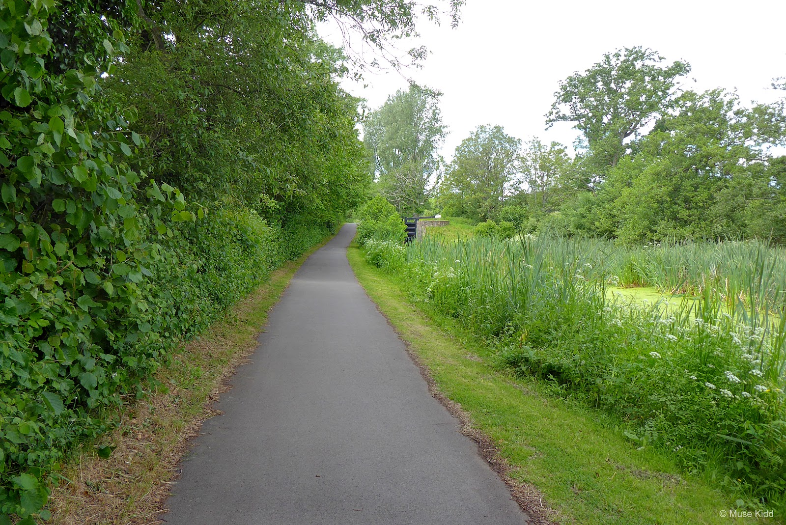
For this part of the ride the path surface changes over to finely packed gravel and varies in width from six feet to just a single-track, but it is generally very smooth. Some places may have pools of standing water, but the path is completely flat as it weaves alongside the canal and through the countryside.
The main concern you will encounter are the many small bridges you must pass under. In some cases you can cycle, but for many it is safer to get off your bike and walk. Regardless, it's always a friendly reminder to give a shout or ring your bell to alert anyone coming from the opposite direction.
| ▲ Back to |
| ROUTE COLOUR KEY: | Traffic-free | Shared Use | Quiet Road | Steep Hill |
Watch for walkers and their dogs, especially at bridges! Remember pedestrians have the right of way. (Use your bell to let folks know you're coming through.) Take your time. Stop often. Take pictures. You've got five miles of lovely scenic Wales. Enjoy!

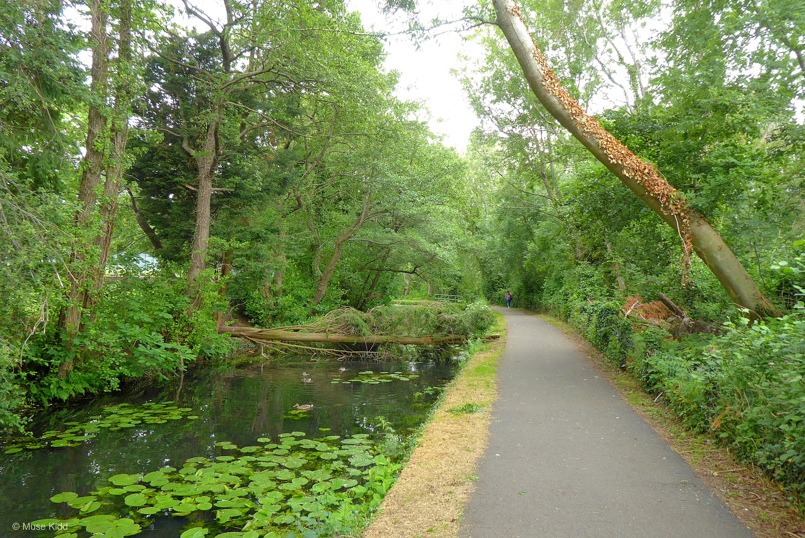
You'll immediately notice a change in both the scenery and the canal path itself. This is a landscape photographers nirvana. It's hard to not a take a great photo.


You'll pass under 20 bridges between Pontymoile and Bridge #72 (our exit point). They come in all shapes and sizes. Some are quite easy to cycle under whilst others are rather low so it's suggested that you dismount and walk.
I also suggest stopping at some point, getting off your bike and walking around. Sometimes the views are quite surprising.
I also suggest stopping at some point, getting off your bike and walking around. Sometimes the views are quite surprising.


Around every bend there seems to be yet another wonderful view. The combination of calm dark water lined by trees, behind which lay wide green pastures and a rolling hillside is simply stunning.


There are some locations where I tell myself to not take any more photos because I have so many, but then there are some places where I simply cannot resist and I take a photo everytime I cycle through.

There are many lovely homes along the canal, most of which have a rather gentrified presentation. However, you will also find the more bohemian aesthetic tucked in between the many farms and pastures.


And of course, boats add to the charm and character of the canal. Be sure to wave hello if you pass one puttering along.

All good things come to an end and our ride along the Monmouth & Brecon Canal ends just after Bridge #72. From here it's a quick half mile glide down Park y Brain Lane to the village of Goytre.
Note: One mile further up the canal path is Goytre Wharf. There you'll find a visitor centre (run by the Canal & River Trust), a gift shop and gallery, as well as a coffee shop serving sandwiches, tea & coffee. If you're wanting to stop for a little longer, it's a great place to relax and explore.


At the bottom of the lane you'll come to the crossing of the A4042. It is often very busy, so show caution. Once on the other side the route becomes quiet again. There are shops, a post office, a pub (above on the right), gas station, and even public toilets.

This a a good place to take a break, get of your bike and walk around a bit. There will not be another source for food or drinks for the next 11.5 miles.
PART THREE
ON ROAD |
Goytre to Raglan |
Location(s) include: Mostly quiet lanes with some busier roads
Total Distance: 11.5 mi. / 18.5 km
Elevation Change: +470 ft / -628 ft
Total Distance: 11.5 mi. / 18.5 km
Elevation Change: +470 ft / -628 ft
This next section I call The Great Oak Loop and it takes you into the heart of the Vale of Usk as you weave along quiet country lanes for most of the 11.5 miles. The Skirrid, the Blorenge, and the Brecon Beacons will be visible across many of the wide open farmlands you pass.
The route is entirely on the road with a few small hills and one short, but sharp climb (just before the Raglan Castle viewpoint). There are no signs or waymarkers, so you will need to follow the map and directions closely. The route weaves along quiet lanes through the countryside— all the way to the town of Raglan.
There is one very short section where the route follows the B4598 (approximately 1000 ft.) and then just before entering Raglan there is a very busy roundabout at the A40 which must be navigated with caution. There will be no facilites or access to food or drinks for the next 11.5 miles. Enjoy the ride!
| ▲ Back to |
| ROUTE COLOUR KEY: | Traffic-free | Shared Use | Quiet Road | Steep Hill |
Once you have crossed the A4042, Park y Brain Lane becomes School Lane. Follow School Lane as it curves a short distance (past the play park) to turn left onto Newtown Road. Follow Newtown Road approximately 1.2 miles to the junction of Chain Bridge Road.

This section out of Goytre rolls along gently as it parallels the train line heading north to Abergavenny.


After .5 mile down Chain Bridge road, the road dips slightly just before the junction with The Cottages road. Turn right onto The Cottages road and head up the small hill.

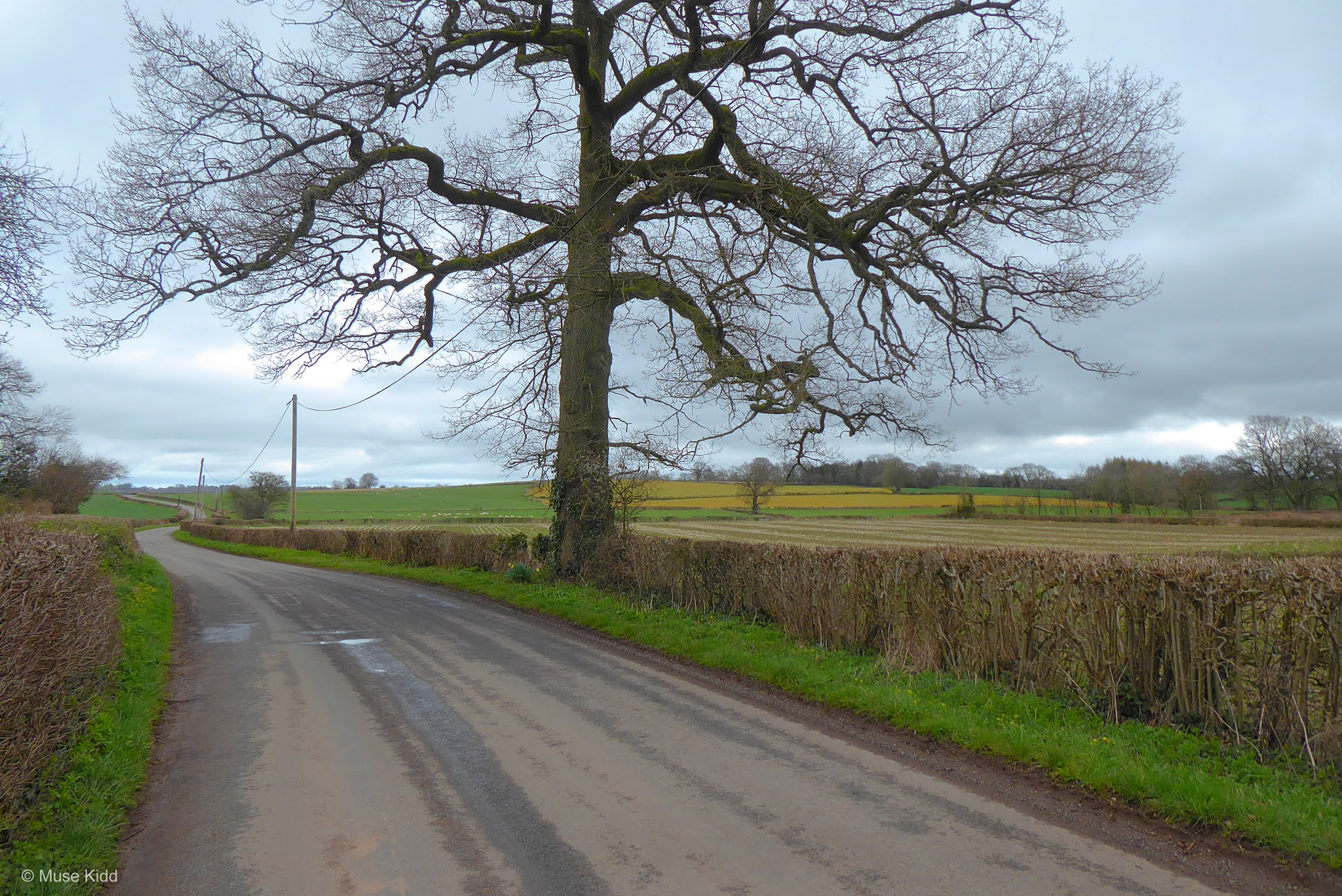
The route now heads into the country where traffic is practically non-existant. Farmers are plodding about in their tractors, sheep graze lazily the fields. Far off to your left, The Skirrid can be seen standing alone on the horizon.

You will follow the Cottages road for approximately two miles, passing through the very small village of Llanvair Cross, before reaching the junction of the B4598.


A little further along The Sugar Loaf can be seen far off on the horizon with it's peak in the clouds (above).
Then the road turns and descends steeply into the valley. This descent is a clue that you're approaching the B4548.
Then the road turns and descends steeply into the valley. This descent is a clue that you're approaching the B4548.

At the bottom of the hill, turn left onto the B4598 for just a short hop across the Usk River (this is the Pant-y-Goitre Bridge as noted on the route map). Then after approximately 1000 ft. along the B4548, turn right onto the first lane which also parallels the river.

Continue along this lane for .5 mile to the very next junction and then turn right. After another .2 mile, turn left toward Llanarth and Llanarth Court.
Note: you will see also signs for NCN Route 42, which you will follow for just a short while as it soon turns off while you will continue on toward Llanarth.

After cycling 1 mile and just before reaching Llanarth proper, turn right toward the village of Great Oak. The lane glides through the lovely little community and circles the grounds of Llanarth Court.


Far off to your left, across the expansive private grounds, sits Llanarth Court (right of center, partially obscured by trees), once the 16th century private estate of Ivor Herbert, 1st Baron of Treowen.
Behind that looms the always impressive; Skirrid.
Behind that looms the always impressive; Skirrid.


Travel another 1 mile and turn right again onto Great Oak Farm Cottages Road.

Passing through the village, follow Great Oak Farm Cottages Road for one mile. The countryside opens up briefly providing more lovely scenery and some excellent cycling that just rolls along.

Great Oak Farm Cottages Road comes to a junction near the A40. Turn left away from the overpass and head north toward Bryngwyn. At Bryngwyn Church, bear right and continue for 1.5 miles to the next junction.


At the next junction turn right toward Raglan and continue along the small lane for roughly 2 miles. You will now begin a circular ride around the back of Raglan Castle.


Then after about .7 mile, the road veers sharply to the right and offers a surprising little climb which is deceptively steep. Thankfully it's short, but when you reach the top the views are spectacular!


As you crest the hill, you will find yourself on a high plateau. Far off to your left you should be able to make out the tops of Raglan Castle. There is a wide pullover and gates where you can stop to get a better look.


Then it's a short and fast ride down the hill to the junction at Clytha Road. Turn left up to the hill to the very busy roundabout. Show extreme caution as you crossover the A40 into Raglan.

Once you've made it past the roundabout, coming into Raglan is lovely. It can be a little busy along the narrow High Street, pedestrians are the main concern, so just take your time. It's worth going slowly to take in the details.


It's a very small village, but there are a couple of pubs, a convenience shop, and a few other local shops where you can re-supply if you have the need. The town square is a great little spot for lunch where you can "people watch" all day.
Note: Additionally, this is the junction with NCN Route 423, which runs between Cwmbran and Monmouth.

You've cycled nearly 25 miles now. Get some rest, stretch your legs. From here the route turns south for the last 19 miles back to Newport .
PART FOUR
ON ROAD |
+ | NCN | 88 | |
Raglan to Newport |
Location(s) include: Quiet lanes with some busier roads, then traffic-free cycle path
Total Distance: 19.2 mi. / 30.89 km
Elevation Change: 1,004 ft / -1,096 ft
Total Distance: 19.2 mi. / 30.89 km
Elevation Change: 1,004 ft / -1,096 ft
The last section of the route follows mostly quiet lanes for the next 15.2 miles. There are a couple of short jaunts on moderately busy roads and there are a few small hills to climb. In Caerleon, the route leaves the road to join NCN Route 88 for the remaining 4 miles traffic-free into Newport.
You will not pass through any villages with shops or facilities until the village of Caerleon, so be sure to check your supplies before leaving.
You will not pass through any villages with shops or facilities until the village of Caerleon, so be sure to check your supplies before leaving.
| ▲ Back to |
| ROUTE COLOUR KEY: | Traffic-free | Shared Use | Quiet Road | Steep Hill |
Begin cycling out of Raglan along Chepstow Road. As you leave town, the speed limit goes up to 50 mph, but the road is wide and mostly straight. Cyclists are commonly found pedalling along here and drivers are generally considerate.

Lord Raglan's Bugatti
After a mile down Chepstow Road, exit right toward the quaint village of Llandenny. The road is unmarked, but pretty easy to spot as there is nothing else along this section.

You can slow down and relax now. The next 3.5 miles are along very quiet, undulating lanes.

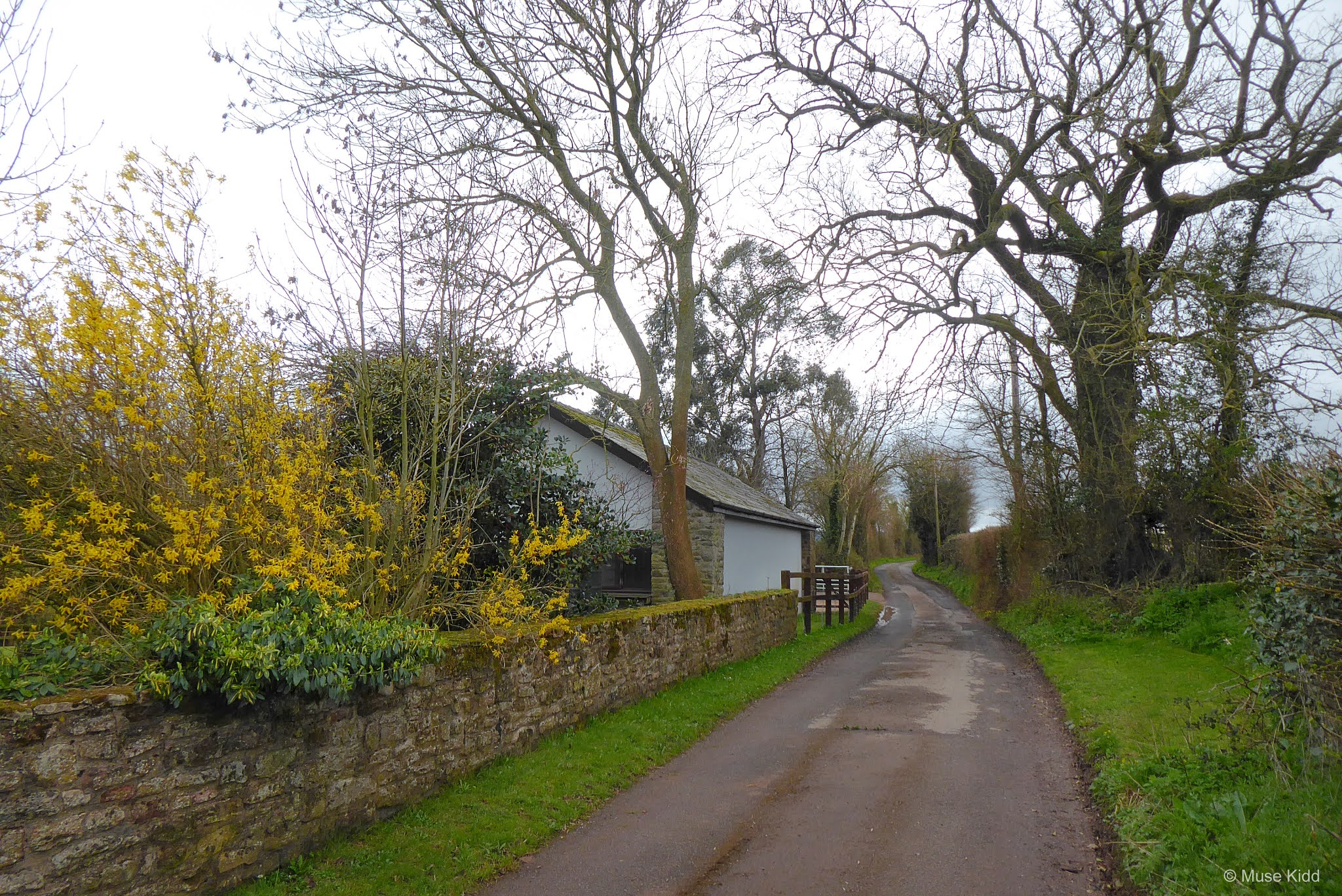


Coming into the village of Llandenny, the 12th century Church of St John the Apostle and Evangelist sits on a slight rise to your right.

After passing the church, the road comes to a junction, turn right and continue into the village centre — passing the village hall and the Raglan Arms pub.

You will soon be out of the village and heading back into the countryside. There is a steep, but short climb up to a junction. Turn left toward Usk and continue climbing. Off to your left there is a lovely view overlooking the village of Llandenny.


This is what cycling in the country is all about. Relax and enjoy.


Approximately 2 miles after leaving Llandenny, the road turns abrutly to the left, passes over the A449, and becomes well-paved and much wider.

Lord Raglan's Bugatti comes to an end at the junction of Monmouth Road (B4235). Turn right and continue on Monmouth Road. Show caution because this is another 50 mph zone and can be quite busy. However, this part is perfectly straight and both lanes are fairly wide so that vehicles can pass with ease. Most importantly, you're only on this road for a short distance.

After .5 mile down Monmouth Road, you should turn left onto a very small lane just past the Llangeview Lodge.
Note: If you continue going straight on Monmouth Road it will lead you into the town of Usk in approximately two miles. It is a fairly large town with a busy high street of shops, hotels, pubs, etc.

Mouseman's Gate
The lane off of Monmouth Road hasn't a specific name, but there is a small sign pointing toward Allt-y-Bella; a private 14th century farmhouse now converted into a posh B&B.
I've named this section Mouseman's Gate and the next 2.2 miles are exceptional. Enjoy.
I've named this section Mouseman's Gate and the next 2.2 miles are exceptional. Enjoy.


Winding down the lanes with lovely vistas opening at every turn.


Just after crossing over the A449 again, the road climbs slightly and if you look over the hedge to your right, the River Usk can be seen as it slowly winds it way from the town of its namesake. This is also a good location for a short break.
Note: The road following the river is NCN Route 42, which you will join shortly.


Getting back on the road, this section ends a short distance ahead at the junction of NCN Route 42 directly across from the old church in Llanllowell. Turn left and continue up the road along a slight rise.

After .9 mile(s) you will reach another junction. Turn right and drop down the hill toward the village of Llantrisant (leaving NCN Route 42). You will then follow this road for approximately 6.5 miles as it weaves along the River Usk for the remainder of the way into Caerleon. It's a peaceful ride with little traffic and it's quite popular with cyclists.
Note: NCN Route 42 continues going straight which eventually leads to the town of Chepstow.


In the blink of an eye, you'll be out of the little village and heading down a long straight and perfectly flat road. You don't see this very often in this part of Wales.


At the end of the long straight section, you will pass a small junction leading off to your right for Newbridge-on-Usk. It's tempting, yes, but you should keep going straight. (We'll visit that area on another ride!)
Hisotrians say that this was once a Roman road that ran between Caerleon and Usk and along this particular wooded section was once a small Roman outpost. I've been told that it's now called "Gypsies Tump".
Hisotrians say that this was once a Roman road that ran between Caerleon and Usk and along this particular wooded section was once a small Roman outpost. I've been told that it's now called "Gypsies Tump".

The lane then levels out for about a mile and offers some lovely views overlooking the River Usk before turning sharply to your left and passing under the A449. You will immediately begin a sharp but short climb to the other side of the motorway.


The road continues undulating above the A449 for approximately 1 mile before dropping down and back under the motorway again.

You will soon find yourself coming up alongside the Celtic Manor Resort and Golf Course. This is Bullmore Road.

As soon as you leave the area of the resort, you enter the lovely village of Caerleon.

Bullmore Road ends at the junction with New Road in Caerleon. Turn right onto New Road and cross the River Usk once again.


The Hanbury Arms (shown above) is a great place to stop for a bite to eat. Parts of the building date back to the 13th century whilst the views over looking the river are wonderful. You can sit outside on a late afternoon and reflect on the days adventure with a pint. You've not far to go now.

NCN Route 88 begins just across the road from The Hanbury Arms. The route is traffic-free and will lead you for approximately 4 miles back into Newport City centre.

Caerleon was once an important Roman city and is a fascinating place. The National Roman Legion Museum is quite interesting and the Roman Ruins are a great place to explore.

NCN Route 88 becomes a raised boardwalk snaking alongside the River Usk as you leave Caerleon and make your way into Newport.


Coming around the riverbend the traffic-free section continues for a short distance before passing under the very busy (and loud!) M4.

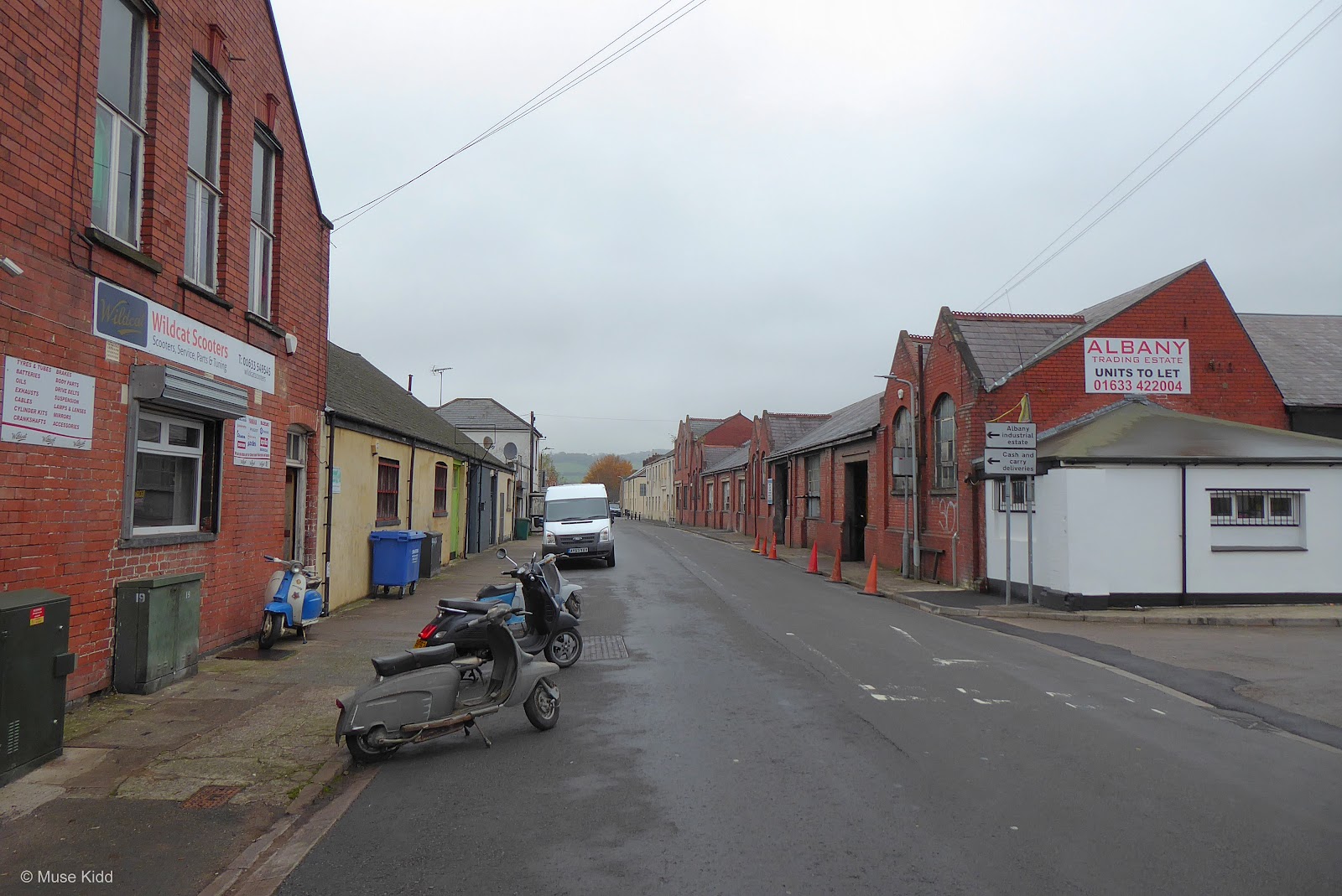
Immediately after passing under the M4, the route re-enters the roadway where you must then navigate a small roundabout. The next .5 mile(s) follows Albany Street through a mix of industrial buildings and small houses. Show caution!

At the end of Albany Street you also reach the end of NCN Route 88 as it joins NCN Route 47 under the A4042.
From here you can turn left to continue on NCN Route 47 which climbs up and over the A4042 leading you back to the start of this route at junction with NCN Route 49 by the M&B Canal and the M4 underpass.
From here you can turn left to continue on NCN Route 47 which climbs up and over the A4042 leading you back to the start of this route at junction with NCN Route 49 by the M&B Canal and the M4 underpass.

Or you can choose to follow NCN Route 47 back toward the Newport Train Station and city centre. The following photos are just a few snaps heading that way.


This area is very congested with roads heading in every direction, but it's really quite small and the path is clearly marked. You can easily follow the underpass leading to the opposite side of the A4042 and into the city centre. The train staion is less than .5 mile from here.


So ends this journey. Congratulations! I hope you've enjoyed the Raglan Classic!
| ADDITIONAL DETAILS | |
| Raglan Ramble |
Getting to the start: From the Newport Train Station you should exit toward the city centre and make your way across several blocks to the riverfront. The city centre is very congested with most roads being one-way. Show caution! Some parts are closed to traffic with pedestrian only access and you may find it easier (and shorter) to walk your bike(s).
Once at the riverfront, the wide walkway is also NCN Route 47. Turn north (left) and continue through several underpasses and raised walkways zig-zagging your way around to the Monmouthshire & Brecon Canal. Follow the canal path to the junction of NCN Route 49 by the M4 motorway.
Once at the riverfront, the wide walkway is also NCN Route 47. Turn north (left) and continue through several underpasses and raised walkways zig-zagging your way around to the Monmouthshire & Brecon Canal. Follow the canal path to the junction of NCN Route 49 by the M4 motorway.
| ▲ Back to |
| ROUTE COLOUR KEY: | Traffic-free | Shared Use | Quiet Road | Steep Hill |
Returning to Newport Train Station: You should note that returning to the train station is slightly different than the way you began due to one way roads. NCN Route 88 stops at the end of Albany Road directly at underpass for the A4042 and the junction of NCN Route 47. Turn left, following NCN Route 47 south toward town. The route is fairly well-marked, but can be difficult to discover amoungst all the various road signs and assorted road furniture.
| ROUTE COLOUR KEY: | Traffic-free | Shared Use | Quiet Road | Steep Hill |
Before you leave: It's worthwhile to do a little research before you make your trip to learn about the areas you'll be passing through so that you can plan your time. There are several locations with facilities, but they're some distance apart.
You & your equipment: You should bring plenty of snacks and drinks to last the day. It is highly recommended that you also carry suitable rain gear (This is Wales!) Always carry a spare tube, tyre patch kit (with tyre levers), a good quality multi-tool, and a reliable tyre pump. Be sure your bicycle is in top mechanical condition (do the 11-step M-test) and check yourself; are you are physically fit to ride 50 miles?
You & your equipment: You should bring plenty of snacks and drinks to last the day. It is highly recommended that you also carry suitable rain gear (This is Wales!) Always carry a spare tube, tyre patch kit (with tyre levers), a good quality multi-tool, and a reliable tyre pump. Be sure your bicycle is in top mechanical condition (do the 11-step M-test) and check yourself; are you are physically fit to ride 50 miles?
Getting there: All of the routes outlined in this section begin and end at various train stations in the Southeast Valleys of Wales — all of which can be easily reached from Cardiff Central (CDF) or Newport (South Wales) (NWP).
Parking: Because the routes begin and end at train stations, there is generally ample parking. Some locations may charge a daily or hourly fee. Of course you can load your bike up in the car, but why not reduce your carbon footprint and take the train? Plus, taking the train adds to the adventure!
Parking: Because the routes begin and end at train stations, there is generally ample parking. Some locations may charge a daily or hourly fee. Of course you can load your bike up in the car, but why not reduce your carbon footprint and take the train? Plus, taking the train adds to the adventure!
Newport (South Wales) Station
Trains: Most all of the Valley train lines allow bicycles without difficulty. However, it is always best to check first and plan to travel off-peak.

Weather: This is Wales! The weather often changes quickly - especially as you reach higher elevations. Check the weather before you leave!
Find a Route

The following section(s) of the National Cycle Network were used in creating this route. Click the links below to visit the Sustrans website where you can read more on each route.

NCN Route 47
Newport - NCN Route 49

NCN Route 49 /
M&B Canal
M&B Canal
Newport - Bridge #72

NCN Route 88
Caerleon - Newport
Maps & downloads
generously provided by:
Download: Select a map below to view a .pdf file of the route/section. You may then save or print the file for your adventure!
1. Newport - Pontymoile

2. Pontymoile - Goytre

3. Goytre - Raglan

4. Raglan - Newport

Note to Readers: Examine the provided online maps closely to understand conditions prior to your ride. Each route listed includes a colour-coded map indicating specific terrain along with the distance(s). When considering difficulty; remember elevations +/- gains are equally important to distances. Printing the included .pdf maps and/or downloading the GPS file is highly recommeded.
Disclaimer of Liability. Bike Wales™ and everyone associated with this website/blog accept no responsibility for the conditions of the routes discussed. These are simply "suggested" routes of the National Cycle Network that the reader may choose to follow. Any action(s) taken from reading the content herein, is solely the responsibility of those involved.