THE NATIONAL CYCLE NETWORK - THE VALLEYS
Rhymney Valley - Route 468
This richly diverse route has two distinct personalities; first, heading north from Pengam through Bargoed Woodland Park, then continuing further up the Rhymney Valley through the towns of New Tredegar and Rhymney. The route finally ends at the junction of NCN Route 46 at the Heads of the Valley above Bute Town.
Rhymney Valley
468
Pengam - Bute Town
• Distance: 9.7 mi. / 15.61 km
• Elevation: +866 ft / -236 ft
• Travel Time: 1 - 2 hours
• Level: Beginner / Intermediate
• Elevation: +866 ft / -236 ft
• Travel Time: 1 - 2 hours
• Level: Beginner / Intermediate
Part One: 1.5 mi. / 3.54 km
Starting in Pengam, the route entrance is located at the far side of the Bargoed Woodland car park. This section is completely traffic-free and perfect for beginner cyclists or families with small children. There are several small hills which may require some additional effort, however they are quite short and the majority of the route is flat, safe, and easy. There are plenty of benches and picnic tables where you can rest and relax. (For more information see our mini-route: Bargoed Woodland Park)
Part Two: 8.1 mi. / 12.07 km
Continuing from the northern edge of the park, just before Bargoed, the route exits by the very busy roundabout of Station Road and the A469. The next 7.5 miles are better suited for cyclists with more experience. The route is mostly traffic-free and shared-use paths; however, this section also has more hills, road crossings, and it also includes several parts which follow along the road. Some climbs are quite steep, there are crossings at busy roundabouts, and in general, the route is rather complex, especially as it snakes it way through the town of Rhymney (click to view a detail: NCN Route 468: Rhymney).
The route ends in Bute Town with the junction of NCN Route 46 at the Heads of the Valley.
| COLOUR KEY: | Traffic-free | Shared Use | Quiet Road | Steep Hill |
Additional Information:
• Train Station(s): Pengam, Bargoed, New Tredegar, Rhymney
• Bus Stations: Pengam, Bargoed, New Tredegar, Rhymney
• Parking: Bargoed Woodland Park, Bargoed Bus Station, The Winding House, Rhymney Train Station
• Bus Stations: Pengam, Bargoed, New Tredegar, Rhymney
• Parking: Bargoed Woodland Park, Bargoed Bus Station, The Winding House, Rhymney Train Station
Additional Links:
Points of Interest

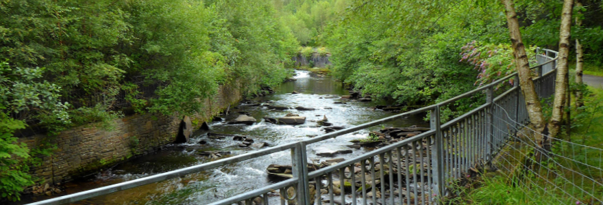
Bargoed Woodland Park - Set in heart of the Rhymney Valley, Bargoed Woodland Park obscures it's industrial past where three collieries once stood. There are 11 sculpted gateways from which to enter and paths criss-cross the park giving you a variety of walking or cycling routes to explore. The river banks are alive with dippers, herons, kingfishers and if you're lucky, you might even spot an otter! ► Read more...

The Winding House - CLOSED! for the foreseable future.
Built on site of the former Elliot Colliery, the Winding House Museum’s centre-piece is the original Victorian winding engine used to operate the cages which transported men and coal between the surface and the mine below. Additionally, there are two galleries; The West Gallery tells the stories of South Wales through the histories of ordinary people. Whilst the East Gallery showcases work from Welsh artists and local community projects. The museum also has a small gift shop and cafe offering teas, coffee, and cakes. ► Read more...
Built on site of the former Elliot Colliery, the Winding House Museum’s centre-piece is the original Victorian winding engine used to operate the cages which transported men and coal between the surface and the mine below. Additionally, there are two galleries; The West Gallery tells the stories of South Wales through the histories of ordinary people. Whilst the East Gallery showcases work from Welsh artists and local community projects. The museum also has a small gift shop and cafe offering teas, coffee, and cakes. ► Read more...
Note to Readers: Examine the provided online maps closely to understand conditions prior to your ride. Each route listed includes a colour-coded map indicating specific terrain along with the distance(s). When considering difficulty; remember elevations +/- gains are equally important to distances. Printing the included .pdf maps and/or downloading the GPS file is highly recommeded.
Disclaimer of Liability. Bike Wales™ and everyone associated with this website/blog accept no responsibility for the conditions of the routes discussed. These are simply "suggested" routes of the National Cycle Network that the reader may choose to follow. Any action(s) taken from reading the content herein, is solely the responsibility of those involved.


